変わりゆく東京の中でも、変わっていない場所、よく見りゃかすかな歴史の息づかいを感じられる部分を古地図を元に掘り起こしていく「東京古地図散歩」。こうしたツアーの先駆けである「歩き旅応援舎」のガイド・星野多慧さんに案内いただきつつ、今の東京を歩いて江戸を見つけていきます。今回は日本橋川の堀留跡から人形町の芝居小屋と吉原遊郭を巡る旅。「吉原遊廓は浅草の浅草寺裏では……?」と思うなかれ、実は江戸の初期に吉原遊廓は人形町にあり、その後浅草に移転したのです。日本橋と人形町の間には掘があり、橋がかけられていたとか。また近くには芝居小屋もあったそう。古地図を片手に歩いていきましょう。
日本橋と歓楽街吉原を分けた橋の跡地は児童公園に
今回の舞台は、日本橋エリアと人形町の間から。ここは首都高の江戸橋JCTの真横。江戸屈指のショッピングゾーンである日本橋魚河岸跡地から少し下流の東側にある、川から物流のために掘られた東堀留川の分岐点から歩き旅、スタート。
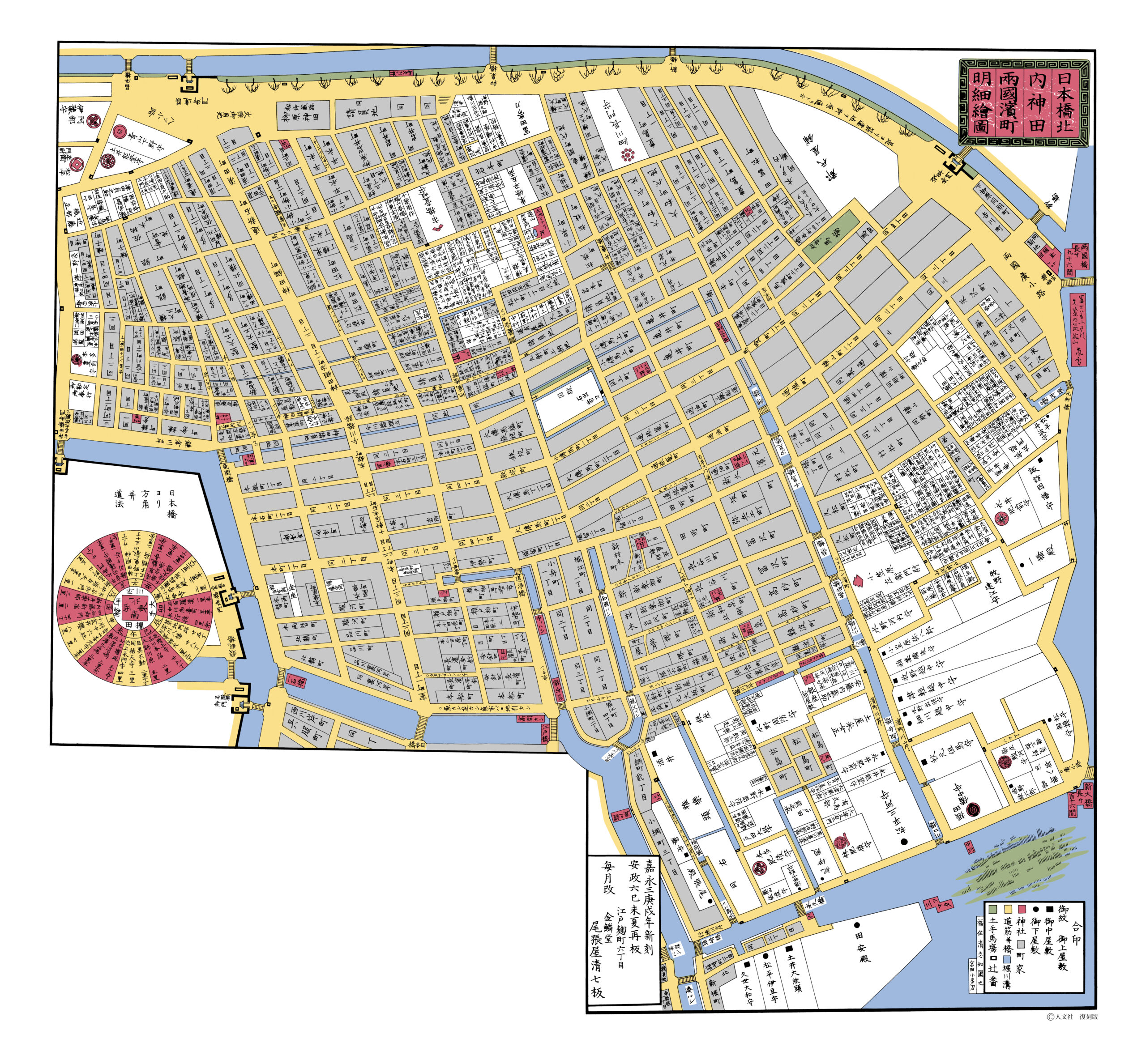
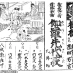
古地図の中央下部の欠けた箇所、日本橋川が直角に曲がった角の部分がスタート地点。少し上流には、堀留と呼ばれるお堀の突き当たりが作られて、西堀留川と呼ばれていたそう。ちょうどそれぞれアルファベットの「J」のようなデザインになっていた。ではちょっとズームしてみよう。
「この位置にはかつて『思案橋』という橋が架かっていました。この思案橋から吉原の芝居小屋と遊郭の両方を見渡すことができたので、ここに立って“さて、どっちに遊びに行こうか”って思案したのが由来だといわれています」(星野さん、以下同)。
今は「小網町児童遊園」という小さな公園になっている。女性と遊びに行くかどうかを悩む場所が今、「児童遊園」という洒落。実際には児童ではなく大人たちが休憩する場所になっていたが。
かつて川だった路地を歩き、橋の痕跡を探す
公園からかつてのお堀の突き当たり、西堀留川だった路地に入っていく。古地図のスタート地点から「J」になっていた部分を下から登っていく形で歩いて行く。
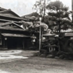
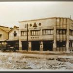
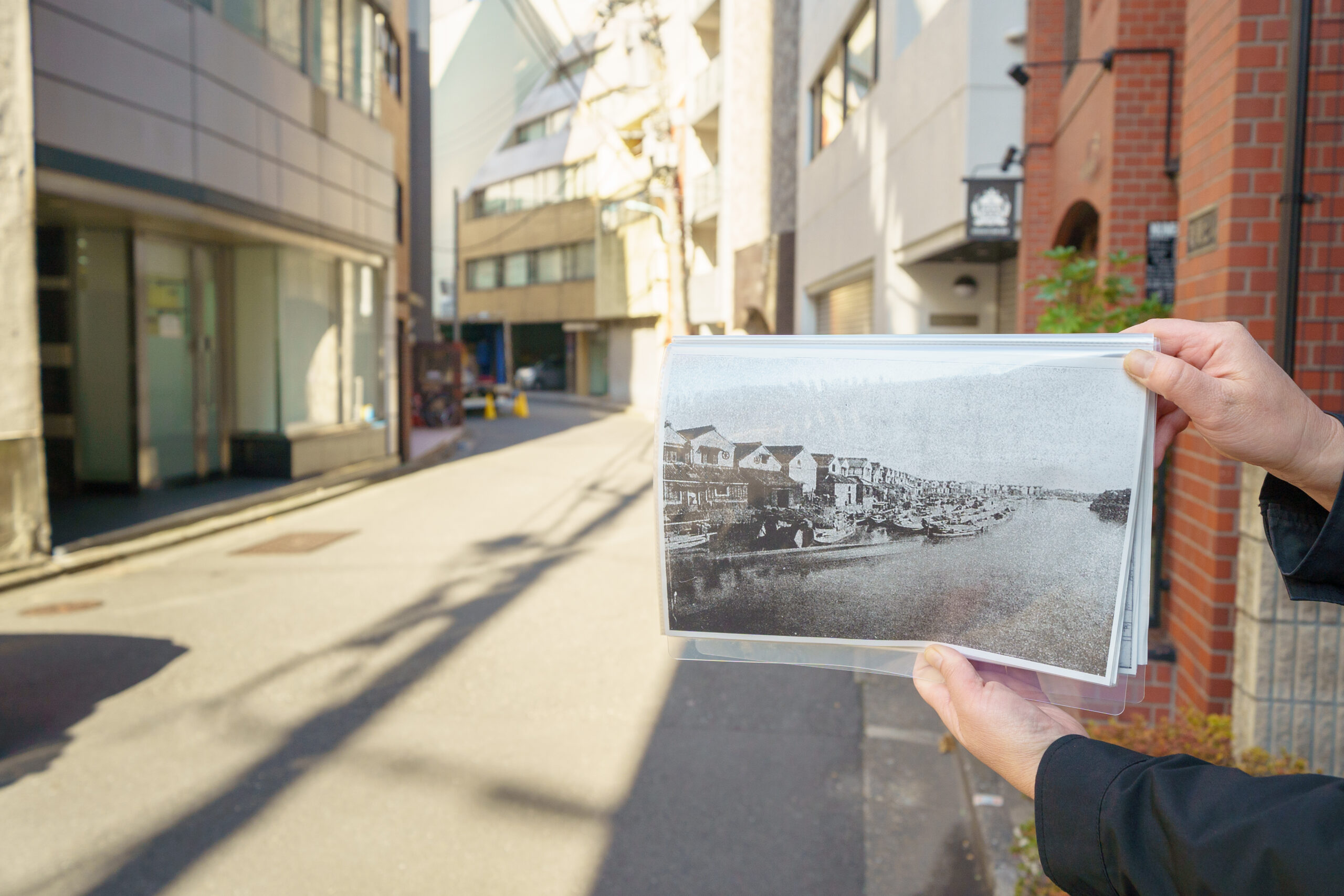
「実は戦後まで、ここに川はあったんです。昭和23年から24年にかけて、戦後の残土処理のために埋め立てられました。なので、こんな写真も残っています」と、星野さん、ファイルを開いて掲げてくれた。
川の痕跡は何も残っていないけれど、地形というのは面白いもので、元の川の流れに沿って、埋め立てられてつくられた道路もきちんと湾曲しているのである。
でも、今の通りと比べると、川幅がずいぶん広く見える。
「あ、この道幅が川幅よりずいぶん狭くなっています。ちょうど、両側のビル一軒分ずつぐらい。あとで、川幅がわかるポイントがあるのでご紹介しますね!」
東堀留川の長さは、約600m。その間に、3つの橋が架かっていた。まずは先ほどの思案橋、そして親父橋。こちらも、今は橋の名残はないけれど、江戸時代から橋のたもとでたばこと薬を商っていた「堺屋」さんが、お店の壁に看板を設置してくれていた。
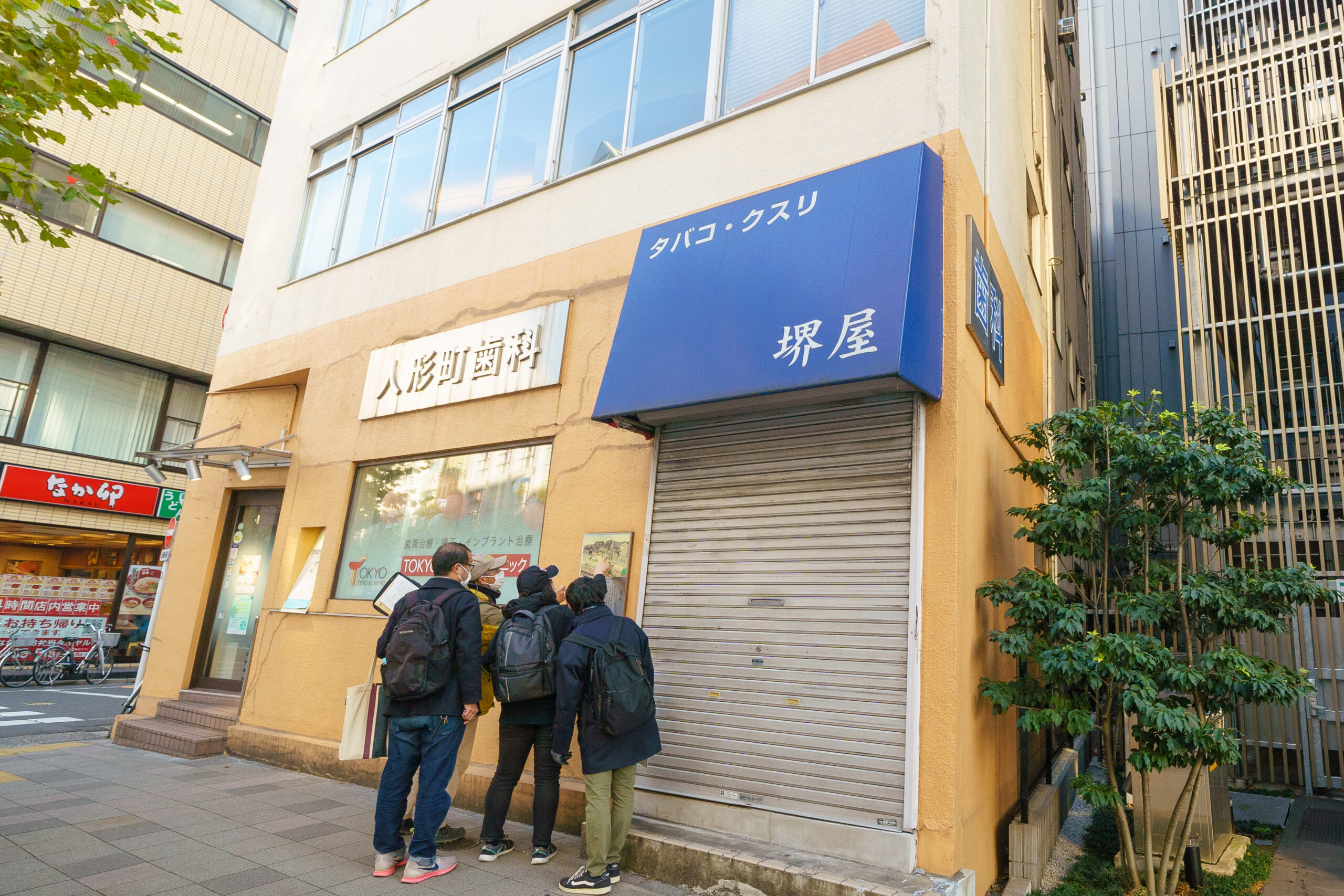
「江戸のあちこちに点在していた遊郭を一箇所にまとめて、幕府の公認を得たのが吉原遊郭でした。これを実現したのが、小田原北条氏の家臣出身の庄司甚右衛門。自ら営んでいた郭で“おやじ”と呼ばれ親しまれていたこの人にちなんで、親父橋と名付けられたそうです」。
地形もそうだが、商いも変わらないところは変わらないのであるなあ。案内板によると、堺屋さんは現在九代目。江戸時代もタバコとクスリを商っていたそうだ。
東堀留川は、このまま街なかを北上し、今の「堀留児童公園」とそれに隣接する「日本橋保健センター」までつながっている。2023年春時点では、堀留児童公園は全面改装中で、2023年秋にはリニューアルオープン予定。水場が設けられるそうで、船の行き交った東堀留川のイメージを感じさせる場所になるかも。
「でも、それでいうとすでに『日本橋保健センター』の駐輪場に、橋をモチーフにしたデザインが施されてるんですよね」と、星野さん。
なるほど、江戸期から少しずつ進化してきたとおぼしき橋の姿が描かれていた。
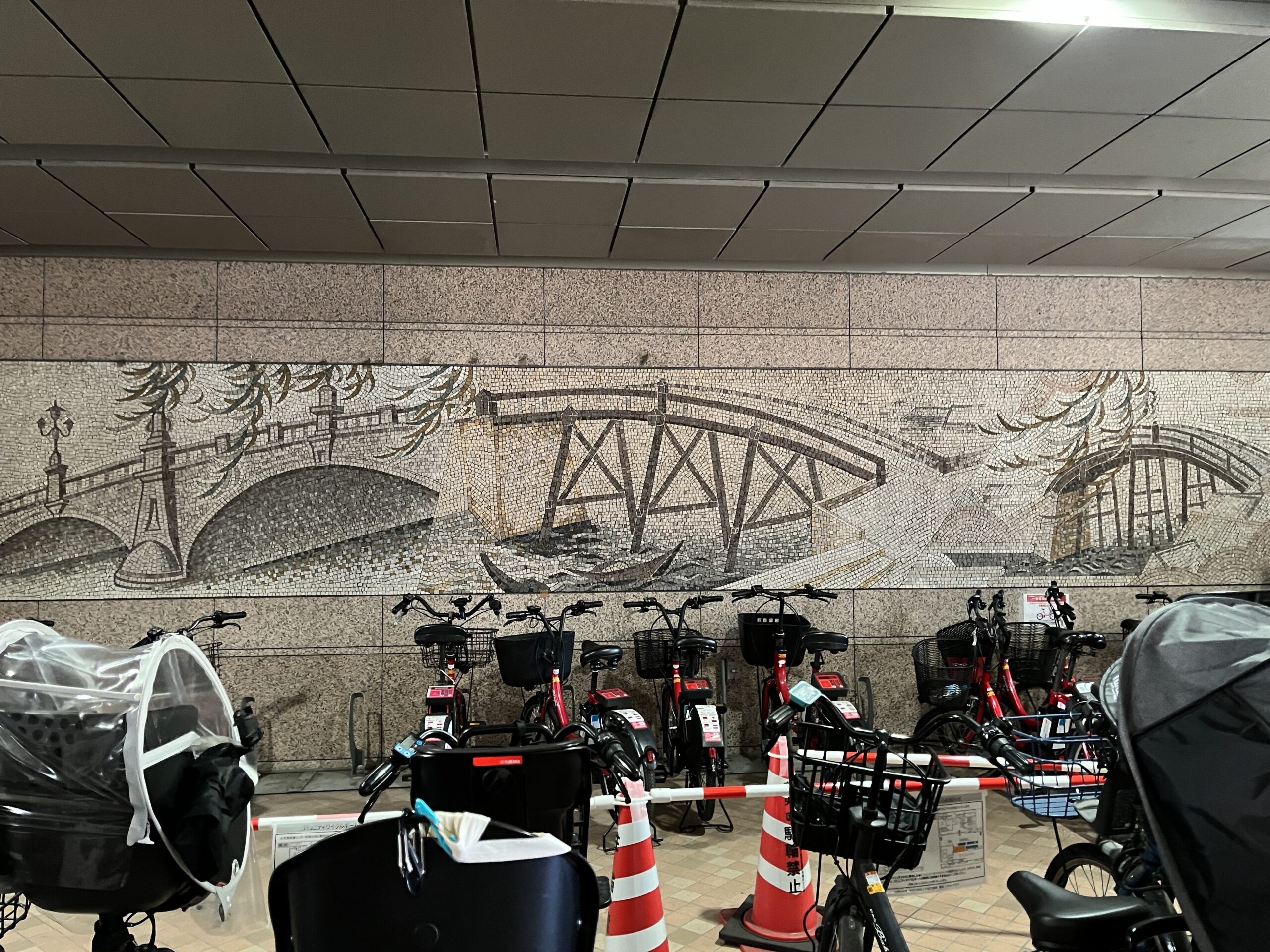
「この公園と日本橋保健センターの敷地の幅がまさに、東堀留川と同じ幅になっているんです。そして、この川の3つめの橋、和國橋があったのは、この施設を通り抜けたあたりだったようです」
公園に隣接する形で建てられた日本橋健康センターの出入り口になっている。ここが東堀留川の和國橋が架かっていた跡地でもある。橋の痕跡はまったくないのでよくよく古地図と地図を見比べてないと気づかない。川幅は手前のコンクリート塀から奥に見える「P」の駐車場看板まで。ごくごく普通の町の風景で、隣には全国チェーンのビジネスホテルがあるのだけれど、なんとそこに江戸の名残が……。
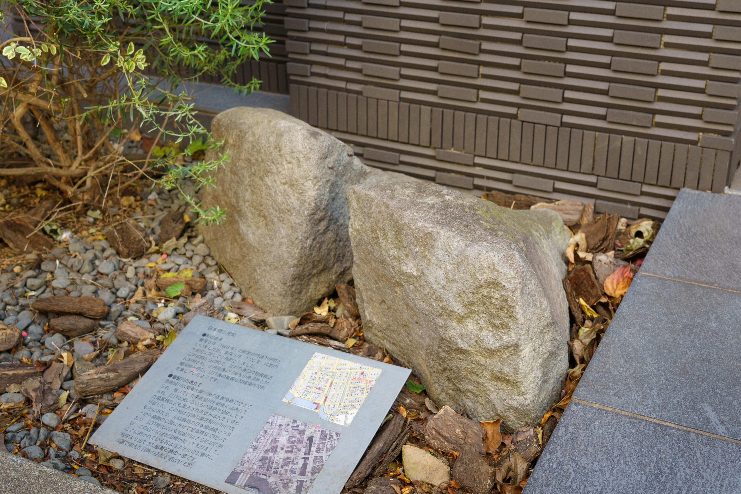
「水運のためにつくられた東堀留川の、船着き場の石垣の一部がホテルの工事中に出土したそうなんです。それが、ホテルエントランス前に案内板と共に展示されています」
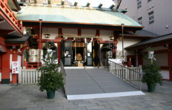
江戸の人たちはクジ好き、願掛けで賑わった神社
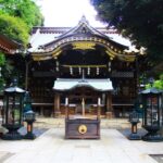
今はなき和國橋を渡った気分で、東に歩を進めて路地に入れば、江戸の地図にもきちんとその名がある「椙森(すぎのもり)神社」に出くわす。
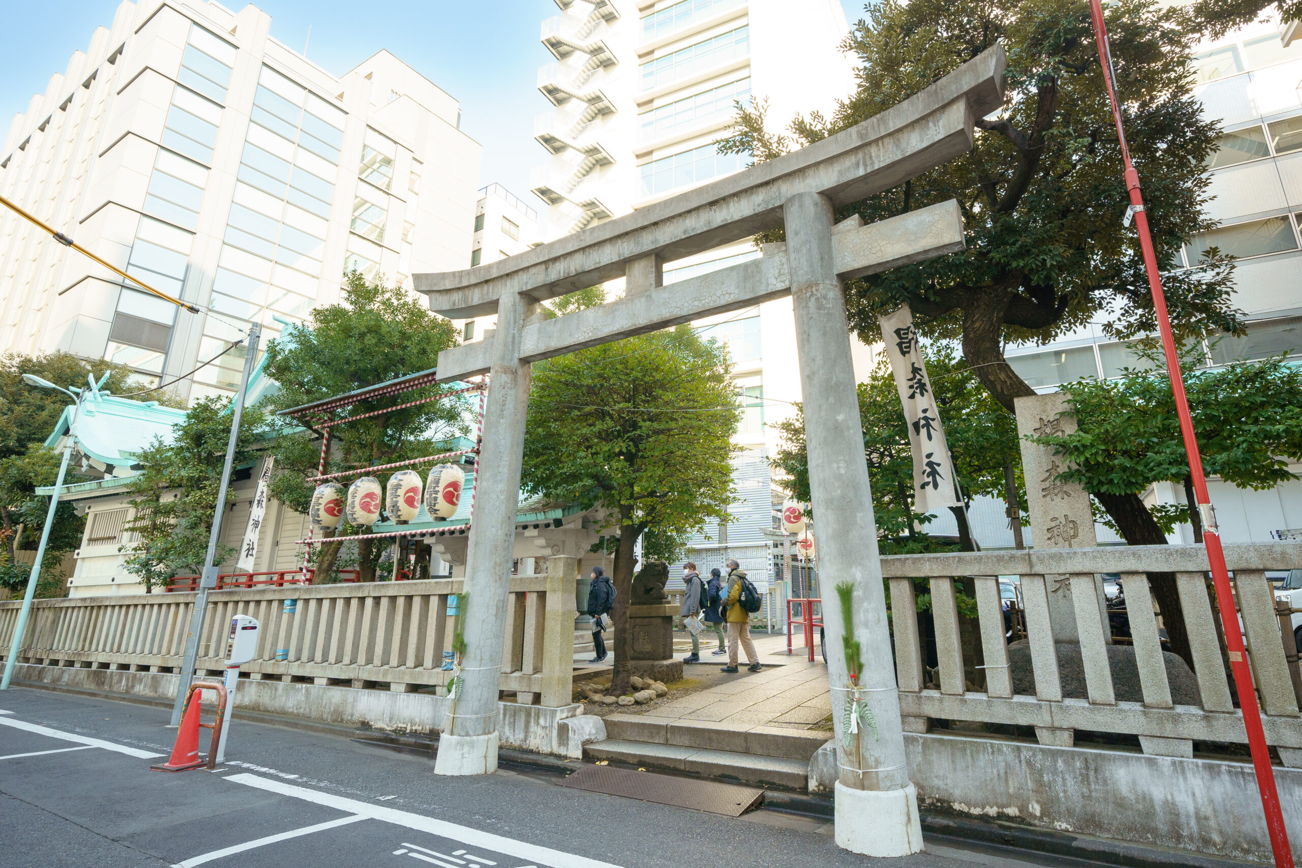
境内の説明板によると、1000年以上の歴史を持ち、江戸時代には新橋の烏森神社、小伝馬町の竹森神社と共に「三森」と呼ばれ、江戸商人発祥の地ともいわれているそうだ。
また「江戸三富」のひとつにも数えられるほど、多くの富籤(とみくじ)が興行された、ともある。
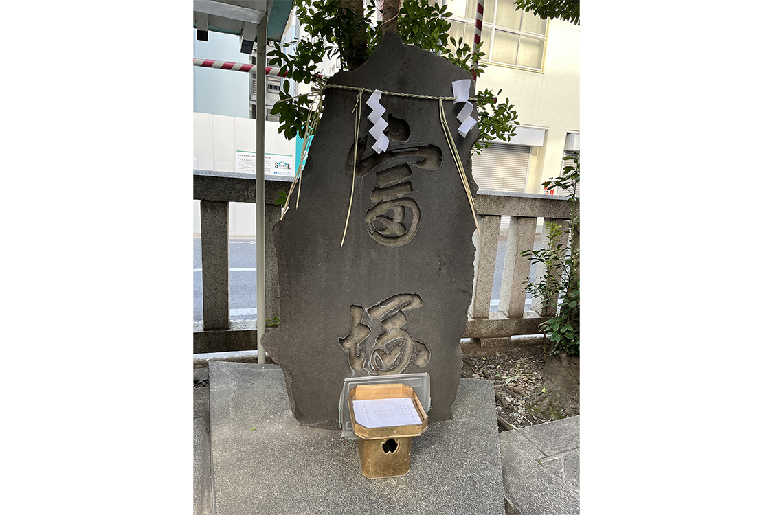
「富籤というのは、今の宝くじですね。江戸時代には、寺社が建物の修繕や再建の資金集めのために、幕府から許可を得てくじを販売することが認められていたんです。宝くじの起源として大正期に建てられた『富塚』は、宝くじのパワースポットとしても知られています」
ちなみに、古典落語の「宿屋の富」や「富久」(大河ドラマ『いだてん』でも重要な役割を果たしましたね)の舞台もこの椙森神社だったりするのである。
芝居小屋の跡地と、通りの名前に吉原遊郭の名残
椙森神社から南下してぶつかる、今の住所でいう「中央区日本橋3丁目2〜7番」あたりが、江戸の「芝居町」だったそう。最初の古地図に「芝居小屋街」と記したエリアだ。
「江戸初期から約200年にわたって、お上に許されて歌舞伎を上演していた中村座、市村座があったのがここです。他にも人形浄瑠璃を打つ小屋や、芝居を見に来た人がお酒や食事を楽しむ茶屋があって賑わっていました。この街が江戸歌舞伎発祥の地でまちがいないようです」
最近では発掘調査も行われ、様々な芝居関係の遺物が出土しているらしいのだけれど、残念ながら、一目で「ここが芝居の町だった」ということがわかる遺跡は発見されず。こんなふうに。
何も知らずにただ歩いているだけでは、なんてことはない、普通の街なのであった。
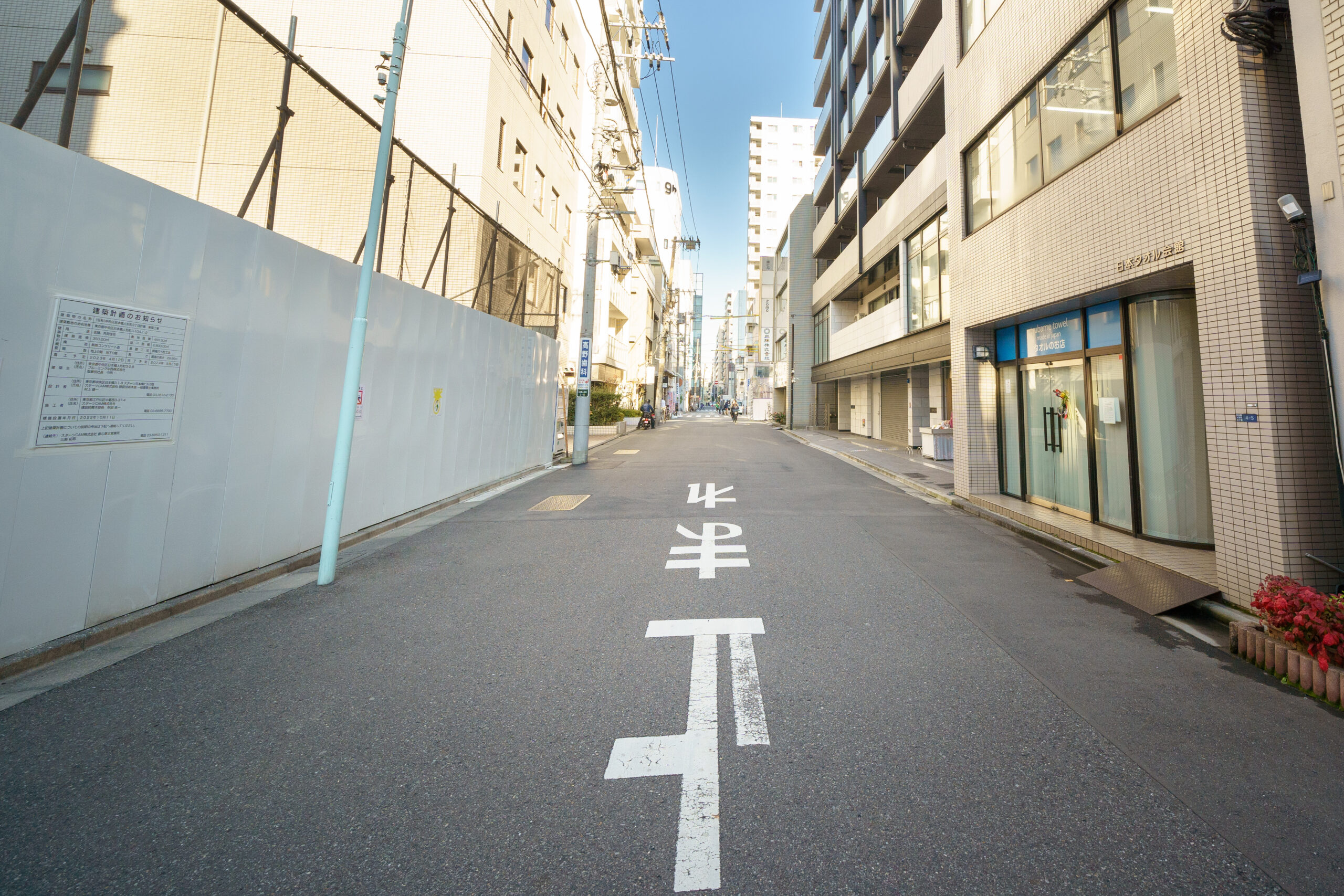
そしてかつての芝居町を横断すると、江戸初期の「元吉原」の「大門」にたどり着く。大門は、この町唯一の出入り口とされた場所で、とくに史跡が残されているわけではなく、この赤い看板の中華料理店と、向かいの茶色いオフィスビルのあいだに佇んでいたらしい。
「大門からまっすぐ伸びるのが大門通り。当時は大門沿いに茶屋が立ち並び、あまり慣れていない人にはお店を紹介してくれたり、馴染みの女郎がいる人は、大門で待ち合わせするようなシステムでした」
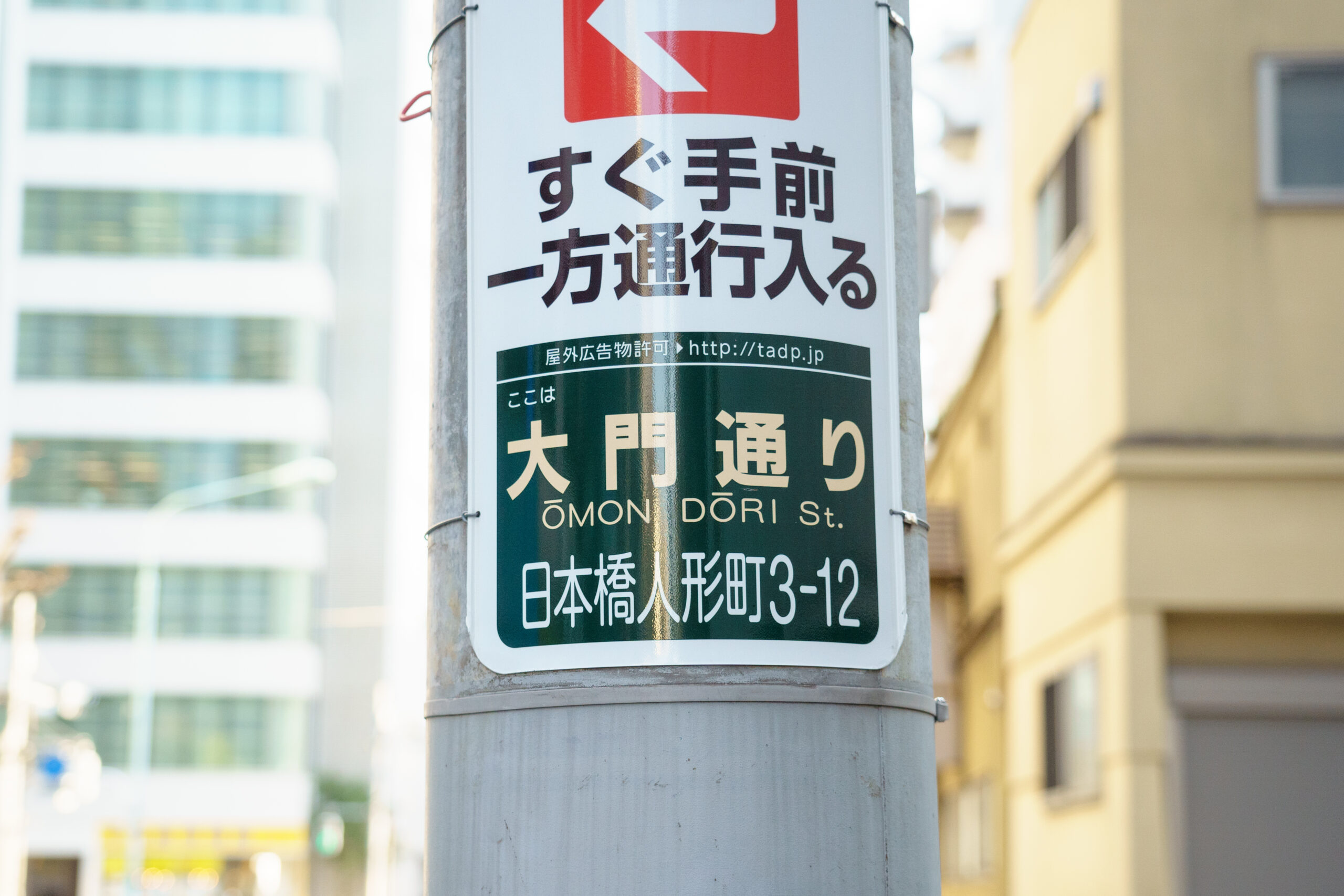
江戸の名残は何もないけれど、今も通りにその名を残している。
元吉原の名残はかつての堀留跡くらいしか残っていない
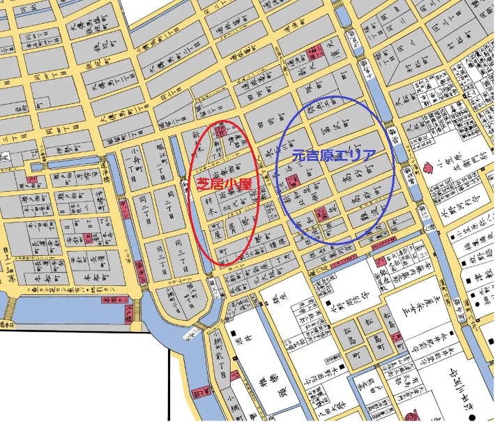
吉原内には厳格なルールがあって、ドラマや映画でよく見るように、女郎たちは自由に吉原の外に出ることはできないようになっていたそうだ。そして、そもそも町がそういう立地になっていた。あらためて、元吉原近辺の古地図を見ていただこう。
元吉原の2辺が堀留で囲われていることがわかる。北側の「長谷川町」と「富沢町」の間の位置にあったのが遊郭の大門だ。地図右手を左上から右下に向かって斜めに走る堀留はかつての「浜町川」。それと交差するかたちでもう1本堀留がつくられ、外部との行き来を遮断している。堀のない2辺は塀で囲われていたという。北側にあるかつての浜町川は、現在では「浜町川緑道」として、川の痕跡を残しているそうだ。
では、浜町川と交わる堀留は今どうなっているのだろうか。
「それをこれから見に行きます!」
星野さんの先導で大門通りを突き進み、都営浅草線を越え、2.5ブロックほどきたところで、止まるよう促される。ここが今回の古地図散歩のクライマックスなのだ!
「ここです」
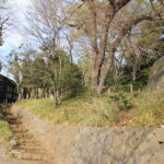
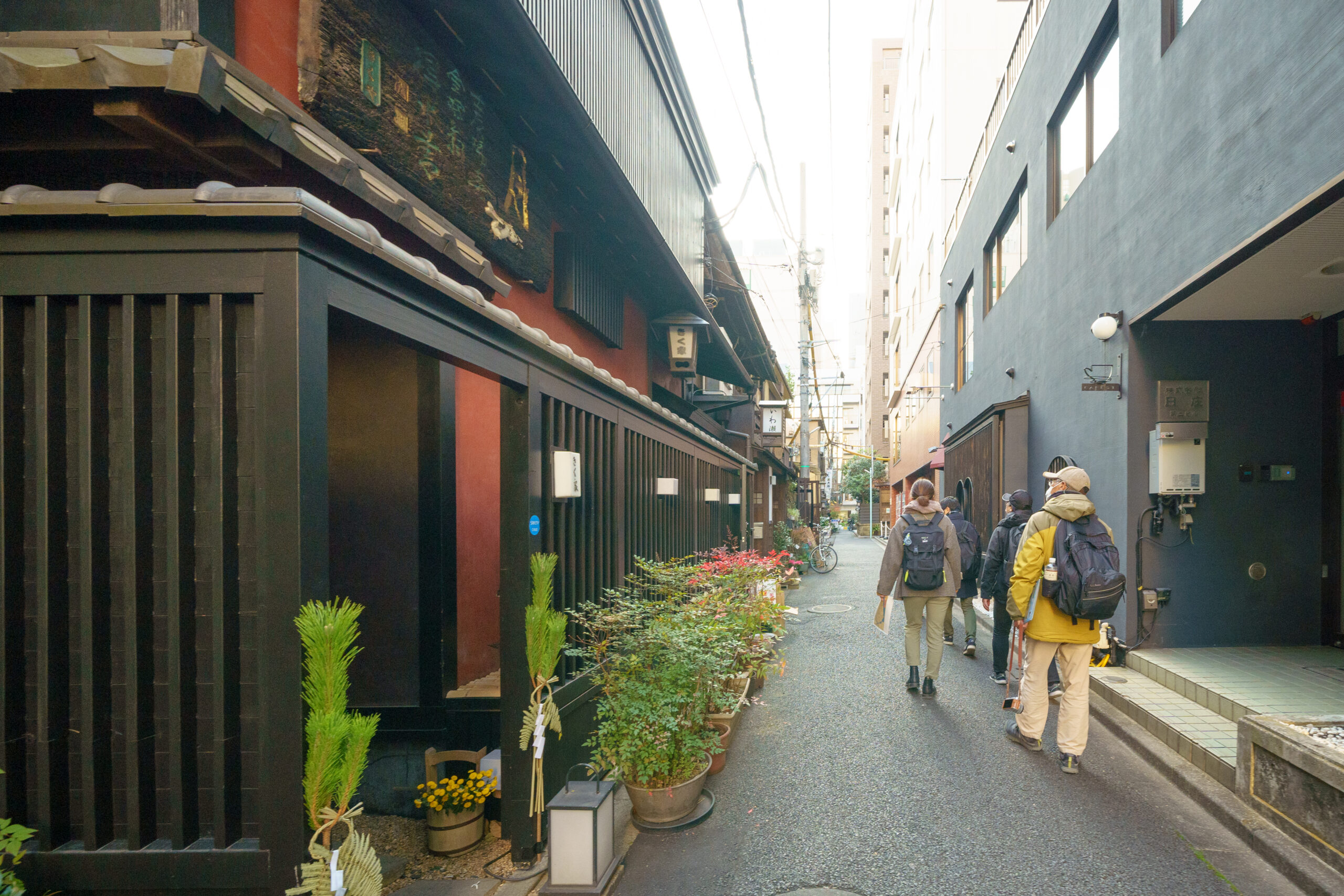
建物と建物に挟まれた狭い路地だった。人がすれ違おうとすると、譲り合わねばならない道幅だが、そもそもここを通るのは、住民のみなさんぐらいだろう。
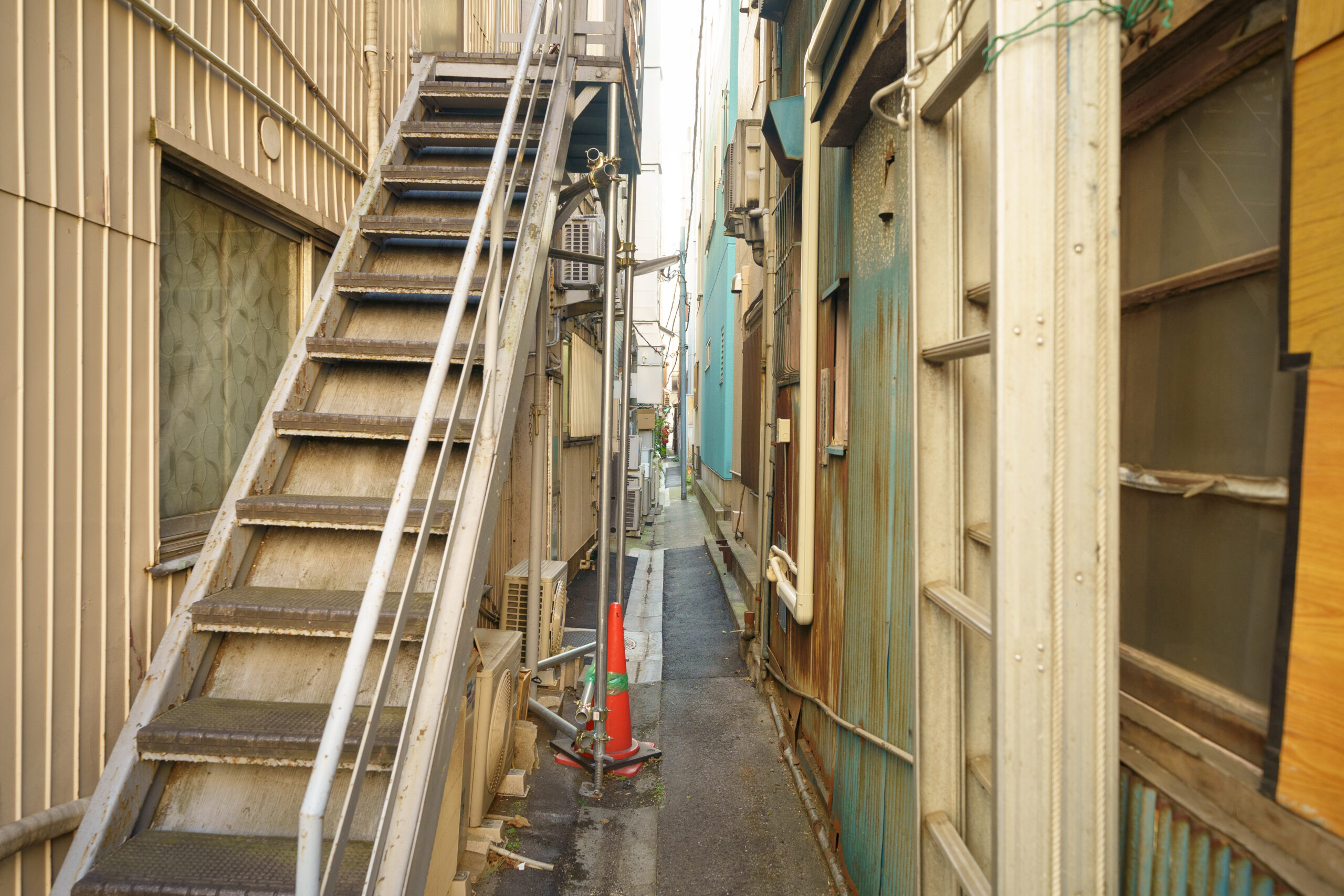
「1657年の明暦の大火の後に、吉原は浅草に移転します。その後は商人が住む町家になって、この近辺にはかまど職人がたくさん住んでいたようです。それで、この堀は『竃川岸(へっついかし)』と呼ばれていました。ここでかまどの荷揚げをしていたようです。当時の川幅はもっと広かったはずです。埋め立て後に、建物がせり出してきてこんな狭い路地になったと考えられます」
圧倒的に地味である。でも、こんななんでもない、知らなければ通り過ぎてしまう路地に歴史とストーリーを見出させてくれるのが、古地図の醍醐味かもしれない。
人形町気分を味わうならば、寺社や老舗を回りましょう
では、最後に、せっかく人形町に来たのだから、「っぽい」ところをいくつか。
まずは「玄冶店」。
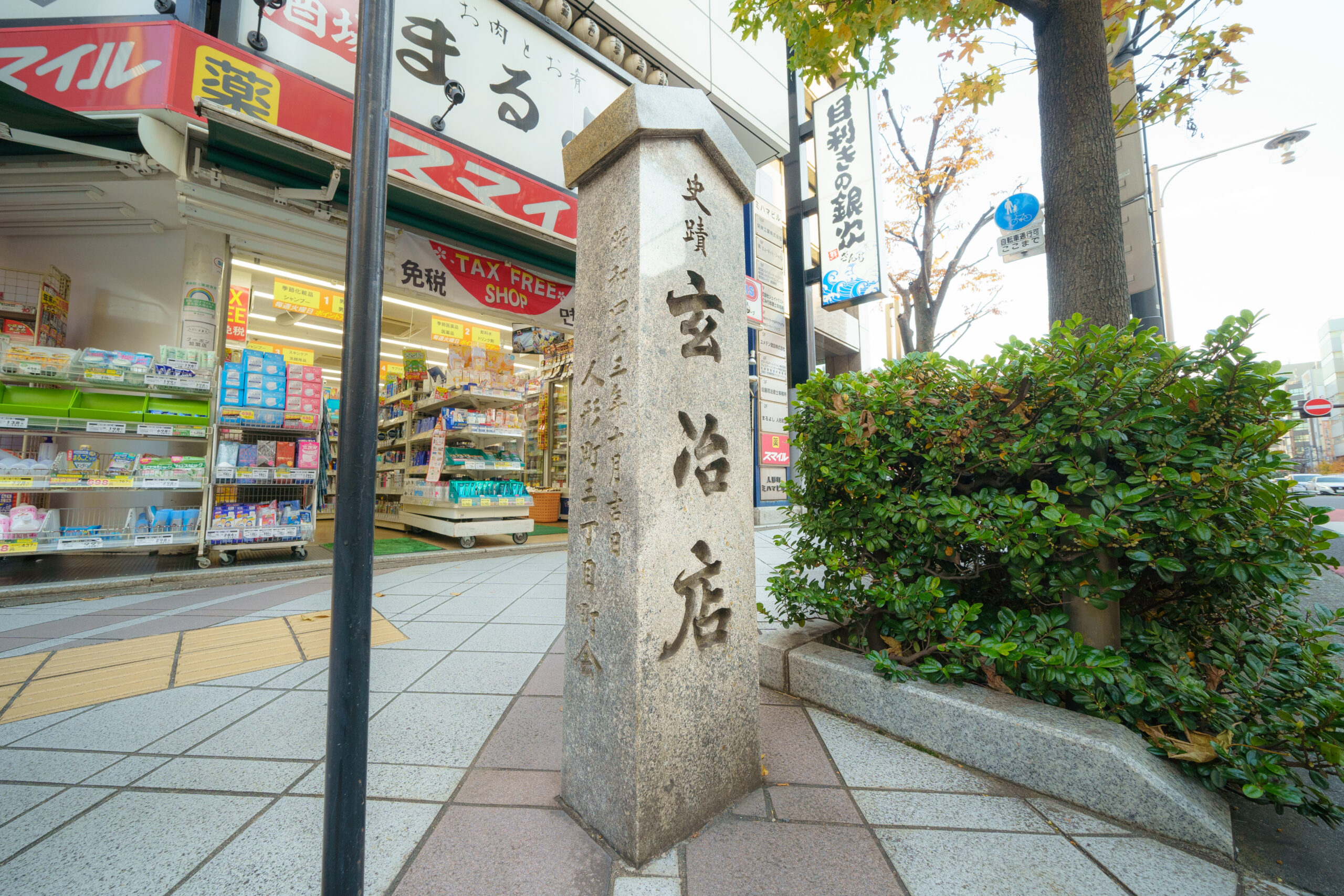
今の中央区人形町3丁目の一部は、江戸時代「玄冶店」という俗称があったという。
「岡本玄冶という医師が3代将軍・家光の痘瘡を治癒したことで幕府から重用され、このあたりの土地を拝領したそうです。後に町民が住むようになり、玄冶にちなんでこの名が付きました」
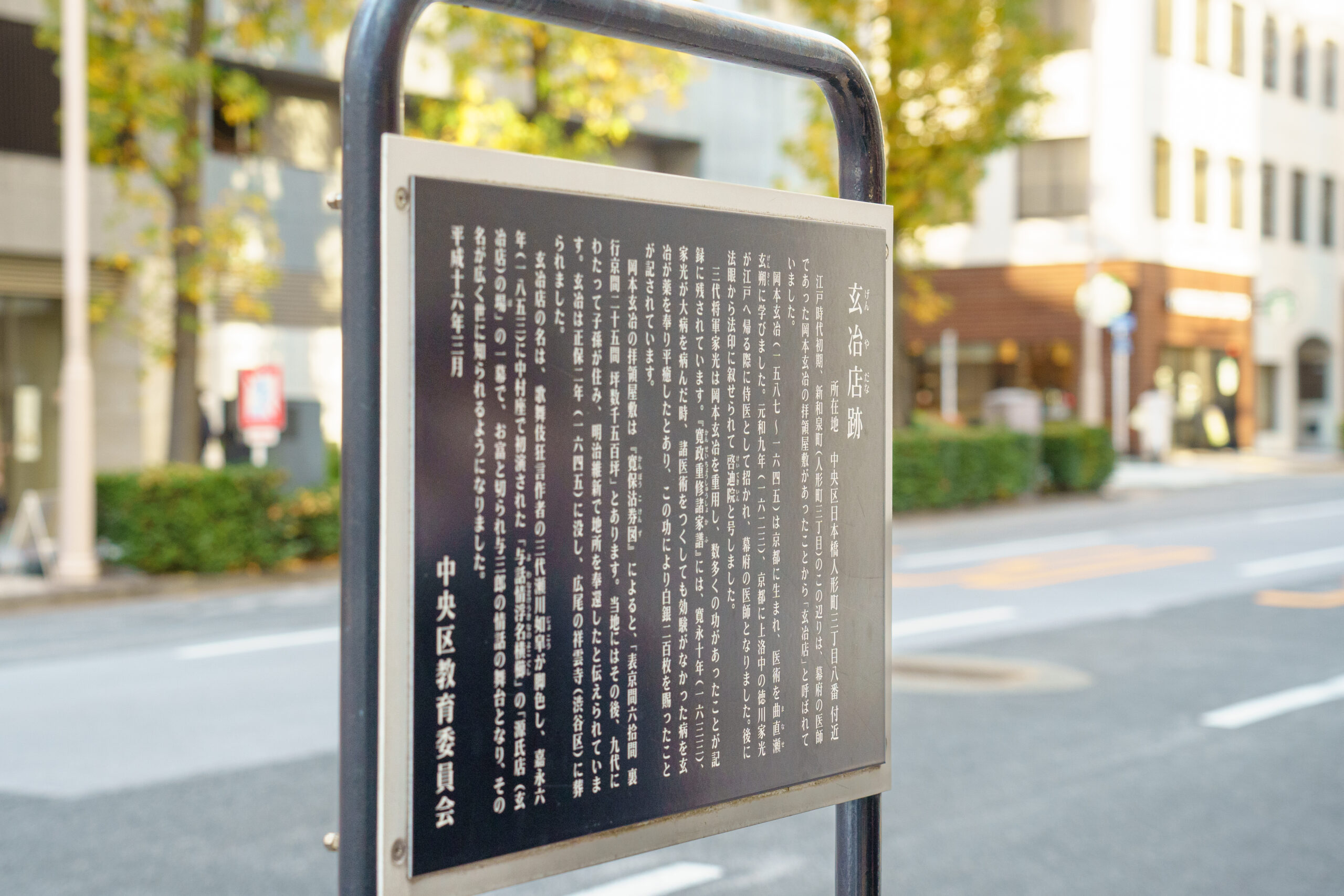
玄冶店という名は江戸に広く知られていて、というのも、ここを舞台にした歌舞伎「世話情浮世横櫛(よわなさけうきよのよこぐし)」が大ヒットしたから。超訳すると、木更津の海で別れ別れになり、死んだと思っていた昔の女に、この町で再会するというストーリー。ちなみに女の名前は「お富さん」。この歌舞伎を下敷きにしたのが、春日八郎の昭和の大ヒット曲「お富さん」だったりするのである。
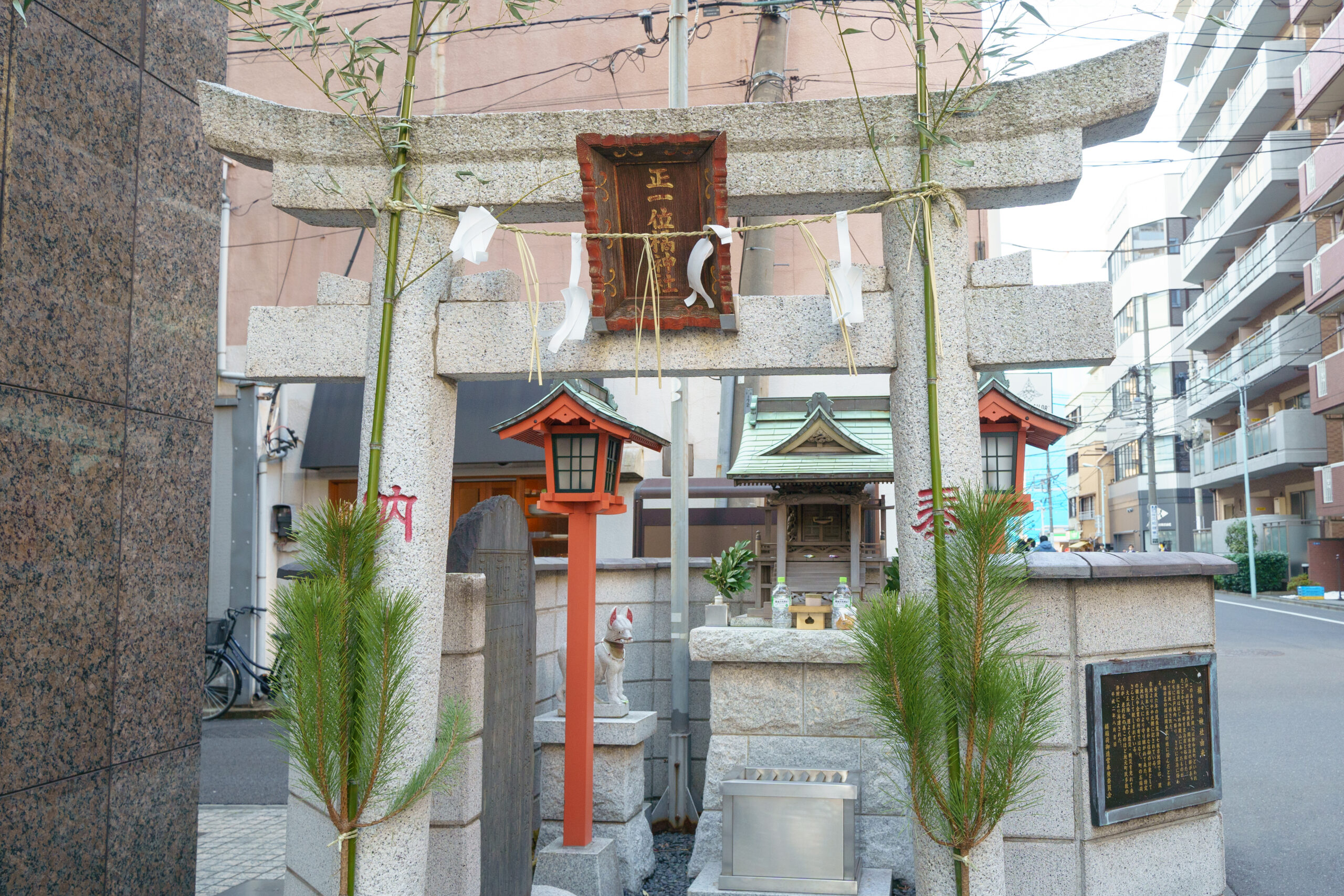
- 岡本玄冶が賜った「橘稲荷」は場所を変えつつ受け継がれている
「元吉原移転後には、この界隈は芳町(葭町)という名前で花街として賑わいました。1977年の町名改正で、『芳町』という名前はなくなったんですけど、芸妓さんも現役でいらっしゃいますし、昔の粋な雰囲気を味わえる場所はいくつもありますよ」
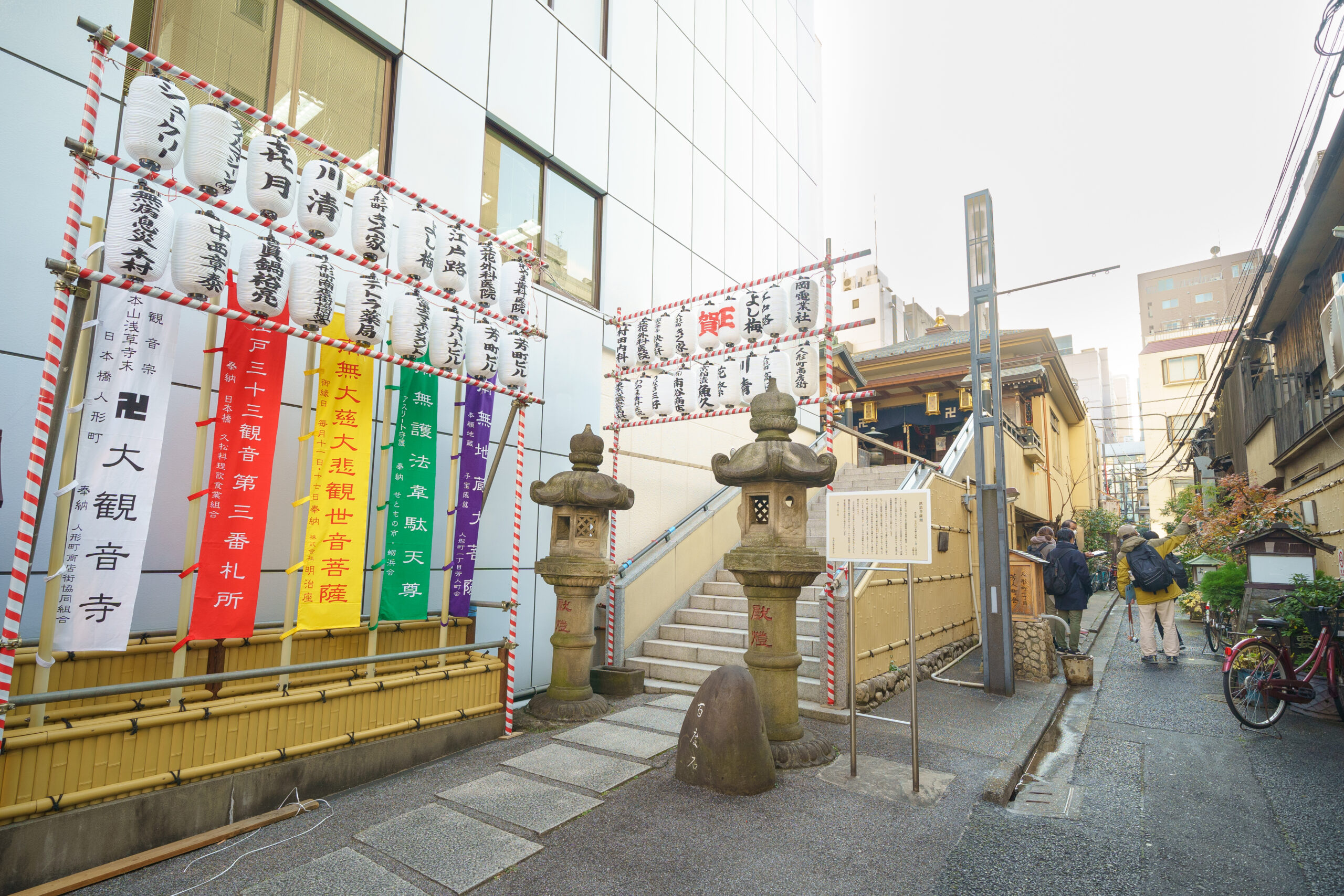
たとえば、『人形町 大観音寺』。このお寺ができたのは昭和15年のことだが、本尊の鉄造観世音像は、もともと鎌倉時代に北条政子が建てた「新清水寺」に祀られていたもの。1.7mの頭部だけの像で、毎月11日・17日に拝むことができるそうな。
そして、この界隈は東京大空襲を免れ、昭和初期に建てられた店が軒を連ねる。かつての料亭の黒塀を思わせるしつらえや、竹垣を眺めながら散策すれば、「人形町」気分も極まれり。

さらに「人形町」気分といえば、こちら。
昔ながらの名店や懐かしい雰囲気のお店が並ぶ「甘酒横丁」を挟んで、向かいの角には『玉英堂 彦九郎』で、老舗の和菓子屋さん。
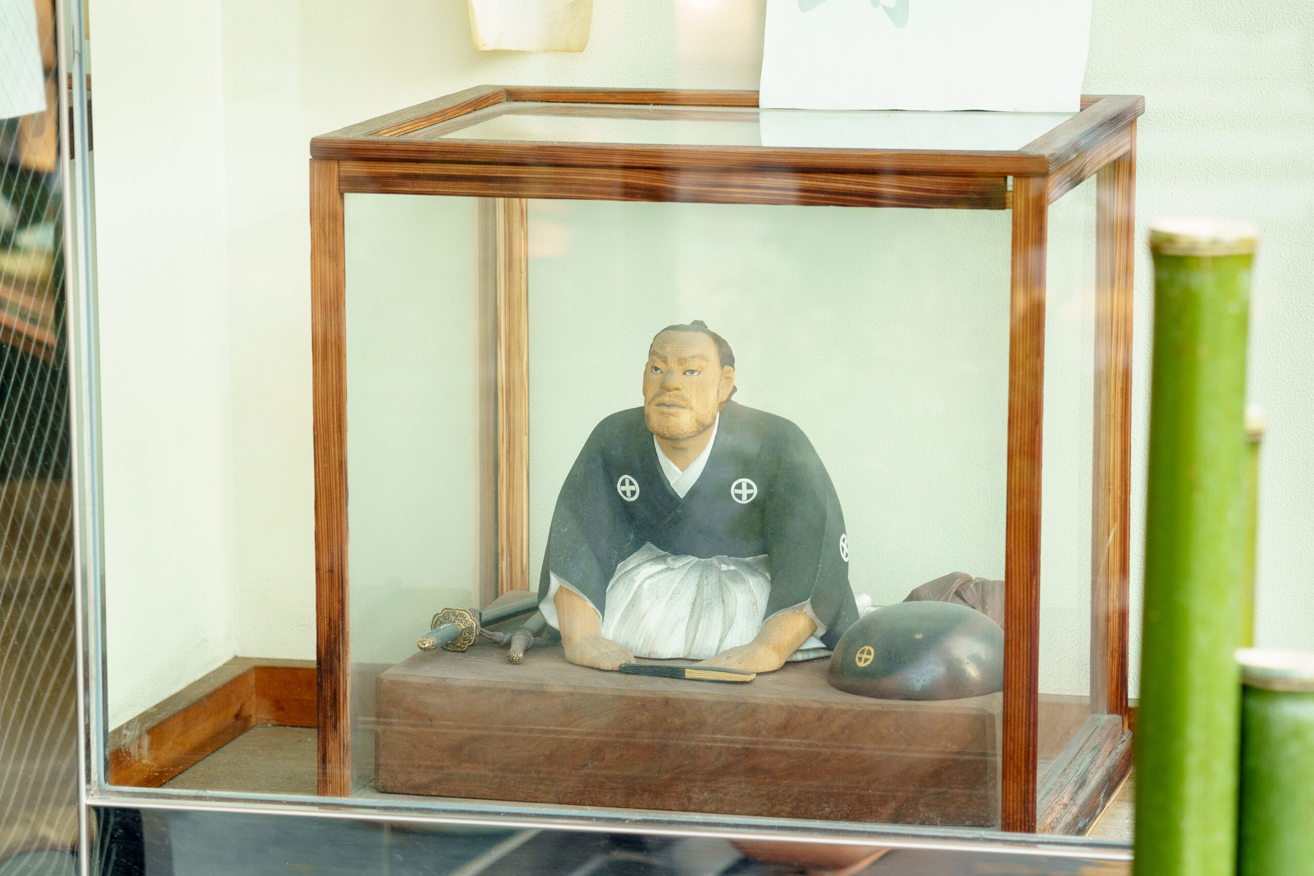
- 「玉英堂 彦九郎」ショーウインドーの高山彦九郎像。寛政の三奇人といわれた思想家で、京都・三条大橋にも同様の銅像がある
もとは京都で創業したお店だそう。
軒先に飾られた人形は高山彦九郎。幕末の尊皇思想家で、明治維新の先駆者とも呼ばれている人物だそう。京都・三条大橋のたもとに玉英堂が茶店を営んでいたときに立ち寄り、彦九郎の名をもらったといわれているとか。
この店をこの地に構えたのは昭和29年。東京出店の際に誕生した「虎家喜」は、縞模様のふわふわの皮に食感のよい粒あんを挟んだ逸品だ。

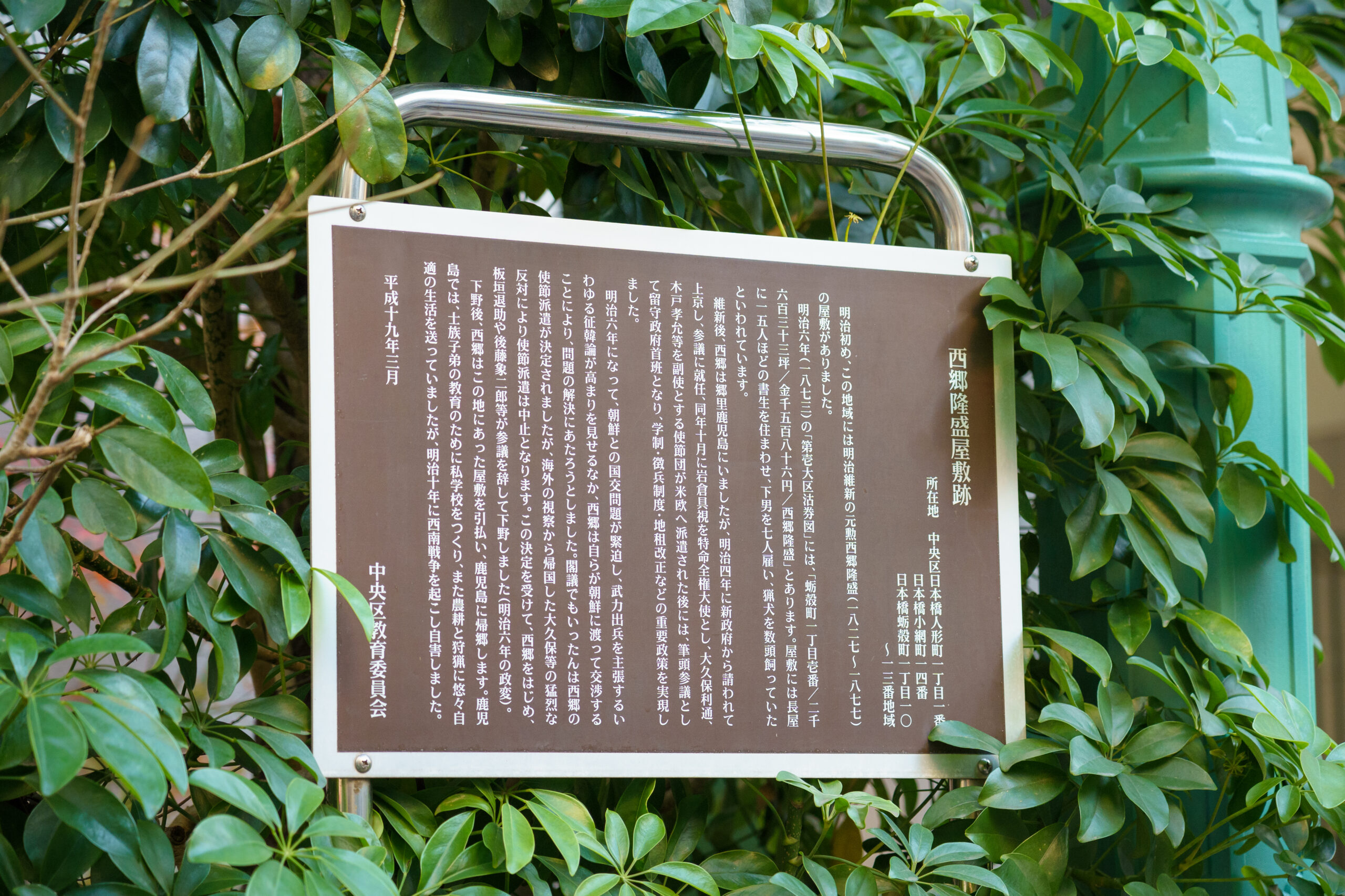
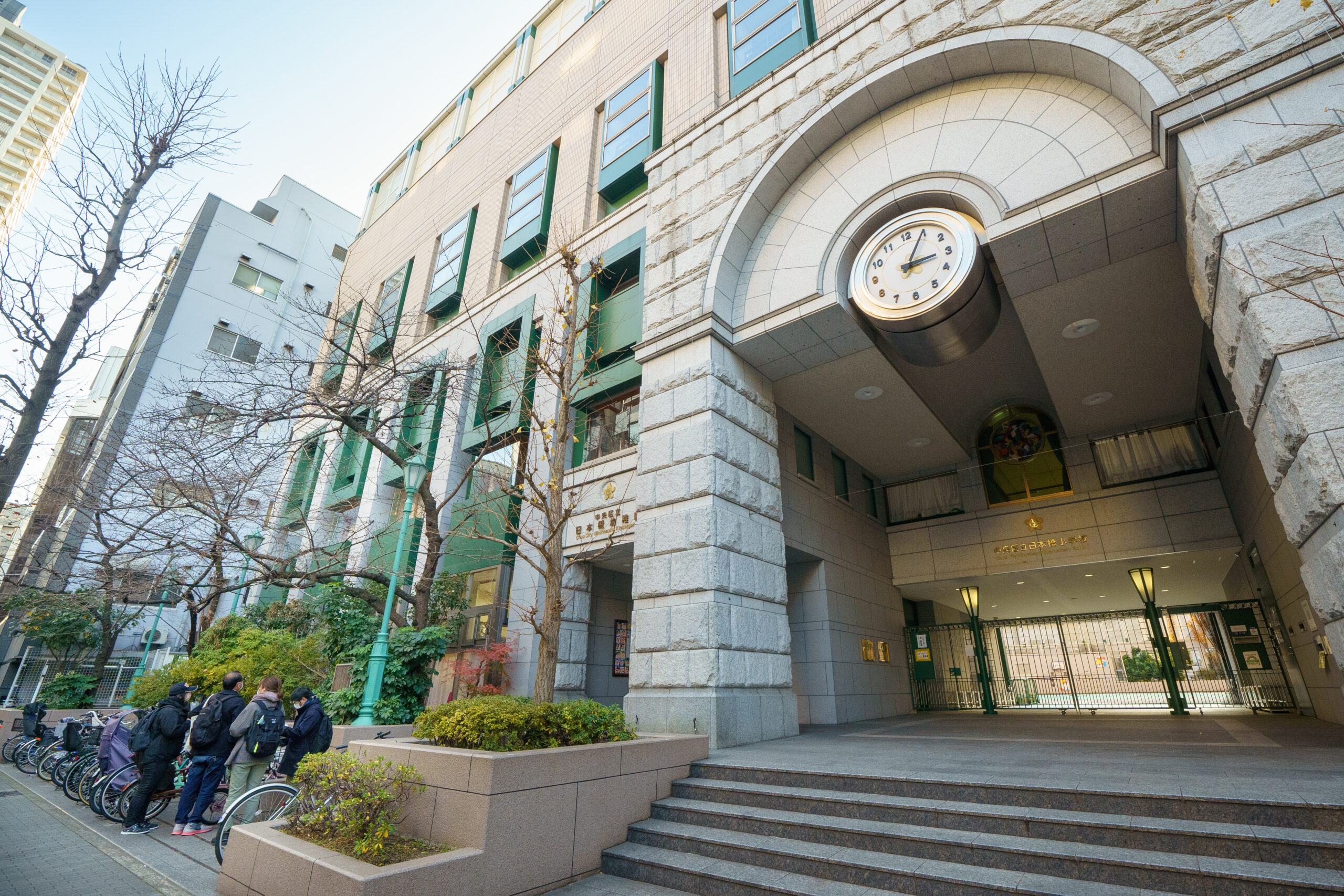
ここから甘酒横丁に入って、買い食いしたり一杯やったりするもよし。すぐ近くの日本橋小学校が、実は西郷隆盛の屋敷跡だったことに驚くもよし。
谷崎潤一郎の生家跡を探すもよし(近所にあるんですよ。ヒントは同じ名字のしゃぶしゃぶ屋さん)。古地図でたどっても楽しい、古地図でたどらなくてもまた楽しい。そんな人形町界隈の旅、これにてお開き。
取材・文/武田篤典(スチーム)
写真/大久保 聡
取材協力/歩き旅応援舎