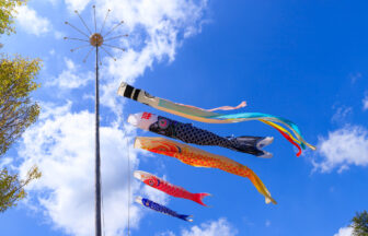
Walking around Edo with old mapsGinza (shopping district in Tokyo)
Part 2: Kyobashi and Ginza from the Edo Period to the Heisei Period Traced by the River
30-meter-deep moatriver in Kyoto and Osakamoat with a castle moat on itculvertriver running between Tokyo-to and Kanagawa Prefecture
Tokyo is a city that can change its shape at the drop of a hat. It is not uncommon to find a vacant lot where something used to stand, and you find yourself wistfully thinking, “This used to be that store,” while tracing back your memories, or perhaps you can’t remember what used to be there even though you used to walk by it every day.
On the other hand, there are many buildings that are surprisingly old and still have a nice flavor.
The Edo Stroll with Old Maps is an enjoyable way to walk the streets of Tokyo, tracing changes and changes, maintenance and traces, with the help of old maps from the Edo period. The tour will take you around the city of Tokyo with a guide from Walking Trip Support House, a pioneer in city walking tours that rely on old maps. The theme of the second edition is Kyobashi and Ginza traced by river.
Ginza used to have four rivers flowing through it.
When we think of Ginza, we immediately associate it with department stores, street-level stores of world-class luxury brands, long-established first-class stores, Kabuki, and traditional crafts. …… Ginza has an image of being an adult district that has history and yet is always new, but you won’t see any of that in this exhibition. After all, the starting point is here.
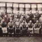
The current landmark is the Nihonbashi Kabutocho Parking Lot, and running above it is the Metropolitan Expressway Loop Route 1. According to Tae Hoshino, a guide from the Walking Travel Support House, four rivers flowed through this neighborhood in the Edo period.
The Kaede River runs from right to left in the center of this map. It flowed from north to south between the Edobashi Junction and the Kyobashi Junction, just below the current Metropolitan Expressway. The Kyobashi River flows from the outer moat of Edo Castle. The Hatchobori River flows out of this area into Edo Bay. From the point where these three rivers intersected, the Sanjikenbori flowed further south.
This time, we will follow the Kaede River southward, tracing the river traces in Ginza.
The starting point of the waterway ruins is the birthplace of Japanese finance
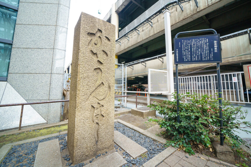
Now, let’s go back to the starting point. We were standing in front of the Nihonbashi Kabuto-cho Parking Lot, but also at the foot of the Kaizoku-bashi (Pirate Bridge) over the Kaede River. The word “pirate” does not refer to the so-called “pirates” but to the navy of the Edo period. The name comes from the fact that the residence of Mukai Shogen Tadakatsu, who was the head of the Navy, was located at the east end of the bridge. ……, the explanation on the bridge monument reads.
Incidentally, this monument is said to be the main pillar of a stone bridge built in the Meiji era (a large pillar at the end of the parapet with the name of the bridge).
The name “Kaiunbashi” was used after the Meiji period (1868-1912), and the bridge itself was replaced by an arched stone bridge. The stone bridge was damaged in the Great Kanto Earthquake, and was replaced by an iron bridge in 1927, and the Kaede River itself was reclaimed in 1962.
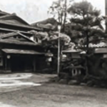
The area has developed as a financial center since the Meiji era,” Mr. Hoshino said, pointing toward a building with a photo of the man who was the subject of a major TV drama.
It was here that Shibusawa Eiichi established Japan’s first bank, the First National Bank. The Tokyo Stock Exchange was just ahead, and directly across the street was the residence of Eiichi Shibusawa. It’s a few minutes walk to the office, which is both enviable and difficult. ……
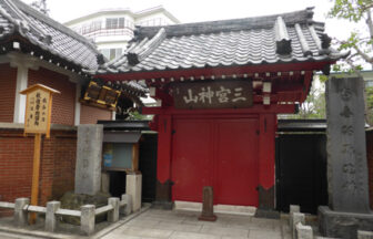
This is a small shrine tucked away in a valley of buildings a short distance down the street. The shrine is a small one, but it has a very clean atmosphere, and the names of major financial institutions are lined up on a beckoning tree dating back to 1966.
If you take a quick peek, you can still see traces of what used to be a river.
According to Mr. Hoshino, one of the secrets to finding traces of the old topography is to “look into the gaps. As a test, I looked at the gap between the highway and the building where I am now and saw a stone wall like this.
This is the site where the river used to be protected by a sea wall. You can get a clearer picture of how the river used to flow here.
There was also a place where a “bridge” was more obviously left behind. This is the Chiyoda-bashi Bridge, where the Metropolitan Expressway intersects Eitai-dori Avenue.
About one block south of the Pirate Bridge, as can be seen, an elevated expressway intersects with a two-lane road, and a car rental office and a convenience store are operating under the expressway.
This bridge did not exist in the Edo period, but was built in 1926 as part of the reconstruction plan after the Great Kanto Earthquake, when the current Eitai-dori Street was passed through. The highlight of Chiyoda-bashi Bridge is that the bridge girders and piers still remain.
I see. And when I peeked into the gap, I found …… that traces of the bridge are indeed still there!
Incidentally, here is a photo of the Chiyoda Bridge before the Maple River was reclaimed.
The bridge is a “rigid-frame abutment bridge,” which is apparently a rare type of bridge structure in which the abutments that contact the riverbanks on both sides are made of reinforced concrete, and the bridge girders that connect them are made of steel.
This way, we can use fewer steel frames. Since the bridge was built at the time of reconstruction from the Great Kanto Earthquake, there was a shortage of materials, which led to this unusual structure. The only remaining active bridge of this type in this area is the Hitotsubashi Bridge over the Nihombashi River.
During the reconstruction of the area after the Great Kanto Earthquake, a plaza (Hashizume Plaza) was built at the foot of the bridge as part of an official plan. The plazas were located at the four corners where they intersected the banks of large bridges, and were equipped with police stations, public toilets, and pumps for firefighting. The Chiyoda Bridge is also planted with grass and trees, and traces of the plaza can still be seen.
Even if the river has been reclaimed, if there is a police box, plaza, or restroom at the four corners of the street, you can imagine that there used to be a river down there. Also, it’s good to remember these places when you need to use the restroom.
Why do the highways in the city center run over the river?
Continuing south along the street that used to be Maple River, we came to Kyu-an-bashi Bridge, where Yaesu Street and the Metropolitan Expressway intersect. When we reached this area, the Metropolitan Expressway, which had been elevated, somehow began to run lower than the ground level.
On an Edo period map, “Etchu-bashi Bridge” is located in this vicinity, and it derives from the fact that at that time it crossed in front of the gate of the Kamiyashiki residence of Matsudaira Echu-no-Mamoru. The current name of the bridge seems to be named after Hisayasu, a Gobonushi of Edo Castle, who had an estate of worship near here. The name was changed when the Yaesu Street was built as part of the reconstruction project after the Great Kanto Earthquake.
Looking down at the Metropolitan Expressway passing under the bridge, it looks just like a river. The reason for this is that the Metropolitan Expressway runs above the river or where the river used to be.
The reason for this is that there are no landowners on the river. The development of the Metropolitan Expressway proceeded at a rapid pace in preparation for the 1964 Tokyo Olympics, and in order to be able to carry out construction without the need to acquire land, the river was reclaimed and the expressway was built through it. It is said that the reason why some parts of the Metropolitan Expressway have twists and turns is because it was built along the flow of the river.
Further down the road, the expressway is elevated again. And this “Danjo Bridge” is the last bridge on the Maple River.
In this area, the Kyobashi River flowing from the outer moat of Edo Castle connected with the Kaede River, which further flowed into Edo Bay from Hacchobori on the west side.
Incidentally, Nakamura Chusui of the Hisshin series was often called “Hatchobori no Husband,” because the residences of the town magistrate’s office, where Yoriki and Doshin (low-ranking samurai and officials) lived during the Edo period, were located on the north side of this Hatchobori.
Sanjuken moat that ran north-south through Higashi-Ginza
Kaede River ends at the confluence of Kyobashi River and Hacchobori, and leads to “Sanjukenbori” beyond it.
The “Danjo Bridge” still retains traces of the bridge, but the “Shiraogyo Bridge” on the Kyobashi River and the “Shinpukuji Bridge” on the Sanjukenbori River, which together were called the “Three Bridges,” are only recorded on a signboard on the shoulder of the road.
The “Sanjukenbori” refers to the width of the river, which today is about 54 m. Located in the center of Edo, it was used as an important waterway for transporting goods, with several “river banks” for loading and unloading cargo. During the Edo period, there was a large crank at the starting point, but in the late Meiji period (1868-1912), a channel was dug in Mizutani-machi, and it was renovated to join directly with the Kyobashi River.
This is Mizutani Bridge Park at the bridge end of Mizutani Bridge, which was built at that time. The building stands where the park originally stood, with a licensed nursery school on the first to third floors and Chuo Ward Mizutanibashi Park on the rooftop.
Following the reconstruction project of the Great Kanto Earthquake, a flat park with fine public restrooms was in operation, but was renovated to its current form in 2018. The building is still properly equipped with 24-hour public restrooms on the first floor.
To the left of the building is the Ginza exit of the Metropolitan Expressway at Ginza 1-chome. This is the starting point of Sanjukenbori, so to speak. It is just between Showa-dori and Ginza Chuo-dori. It is amazing that a river more than 50 meters wide used to flow from here to Shimbashi (Shiodome River that used to flow through Shimbashi).
Remnants of Sanjuken moat as seen through “thin buildings
Reclamation was completed in the 1950s after the Pacific War to dispose of debris and create land in Tokyo. However, unlike highways, the remnants of the river are unknown. Even if someone says, “It used to be a river,” what you see in front of you is an ordinary back alley in Ginza. However, this is where the clue to the “former river” lies.
Look at the building in the middle. The building faces the street, but it’s a little “thin”, right? And there is a building adjacent to it on the back side. The Sanjukenbori River is very wide, so instead of turning the entire river into a road, we made both sides of the river into residential lots and made the road to match the width of the surrounding alleys.
Here is a diagram done at the site.
The “river” in this diagram is the original Sanjuken moat. The entire 54-meter wide river was reclaimed, but only the center of the river was used as a street, and residential land was created on the left and right sides to build buildings. Therefore, it is said that the buildings along the reclaimed land of the Sanjuken moat are generally “thin”.
I realized this again when I followed the remains of the Sanjuken moat southward and came across Matsuya-dori Avenue. This time, I had not been exposed to the glamorous Ginza culture, not even for a moment. However, it was an experience I had never had in the Ginza I had been to before.
You would never know the remnants of the river by the thinness of the buildings (……) in a silver shopping mall where you visit department stores and stationery shops. And there it is again, the remnants of the river.
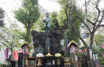
A stylish coffee specialty store and the Asahi Inari Shrine, located in the building that houses the store. The coffee specialty store is named after the very river. The shrine was originally located in this area and sank into the Sanjuken moat after the Ansei Earthquake, but the Great Kaiyoho (a phenomenon in which tides from the sea run up the river like a tsunami) in 1917 caused the “spirit” to reappear from the Sanjuken moat. The explanation of the shrine says that the “spirit” reappeared from the Sanjuken moat and was enshrined on the roof of this building for a number of reasons.
When we reached Harumi-dori Avenue, we came to Mihara-bashi Bridge.
If you look to the east of the busy street, you will see the Kabuki-za Theater, and to the west, Mitsukoshi Department Store and Wako. Finally, I arrived at the Ginza-like area of Ginza.
There used to be a bridge here called Mihara-bashi. After the reclamation of Sanjukenbori, the old Mihara-bashi bridge was reused to create the Mihara-bashi Underground Mall, with buildings on the north and south sides of the street and later a movie theater, and the underground mall itself remained open until 2014.
The difference between the old map and the current city is quite large, but it is fun to find traces of Edo in it. However, not a few of you may have heard of a movie theater called “Cinepathos” that used to be located in Miharabashi. The city changes rapidly not only between “Edo and now” but also between “Showa and now” and “Heisei and now. And we can enjoy the traces of these changes.
This is what I learned while touring the traces of a river that is far removed from the glamorous image of Ginza.
Interview and text by Atsunori Takeda (Steam)
Photo by Satoshi Okubo
Supported by Walking Trip Ouensha