
この1年や半年や、下手すると1週間で変貌してしまう街・東京。新しいビルが建ち、新店舗がオープンしつつも、昔の痕跡が残っていたり、実は江戸時代のままだったりなんてことが意外とあるのです。
そうした時代の証を、古地図を元に楽しむ「古地図で江戸散歩」。古地図歩きツアーの先駆者である「歩き旅応援舎」のガイド・星野多恵さんに案内いただきつつ、今の東京を歩いて江戸を見つけ出していきます。今回は牛込から市谷に至る旅。
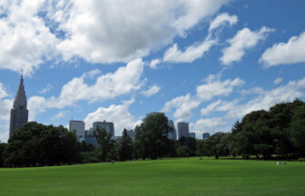
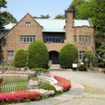
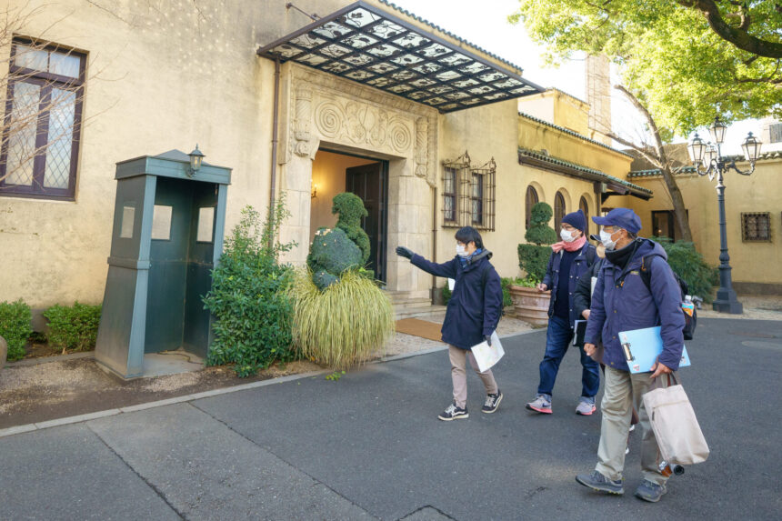
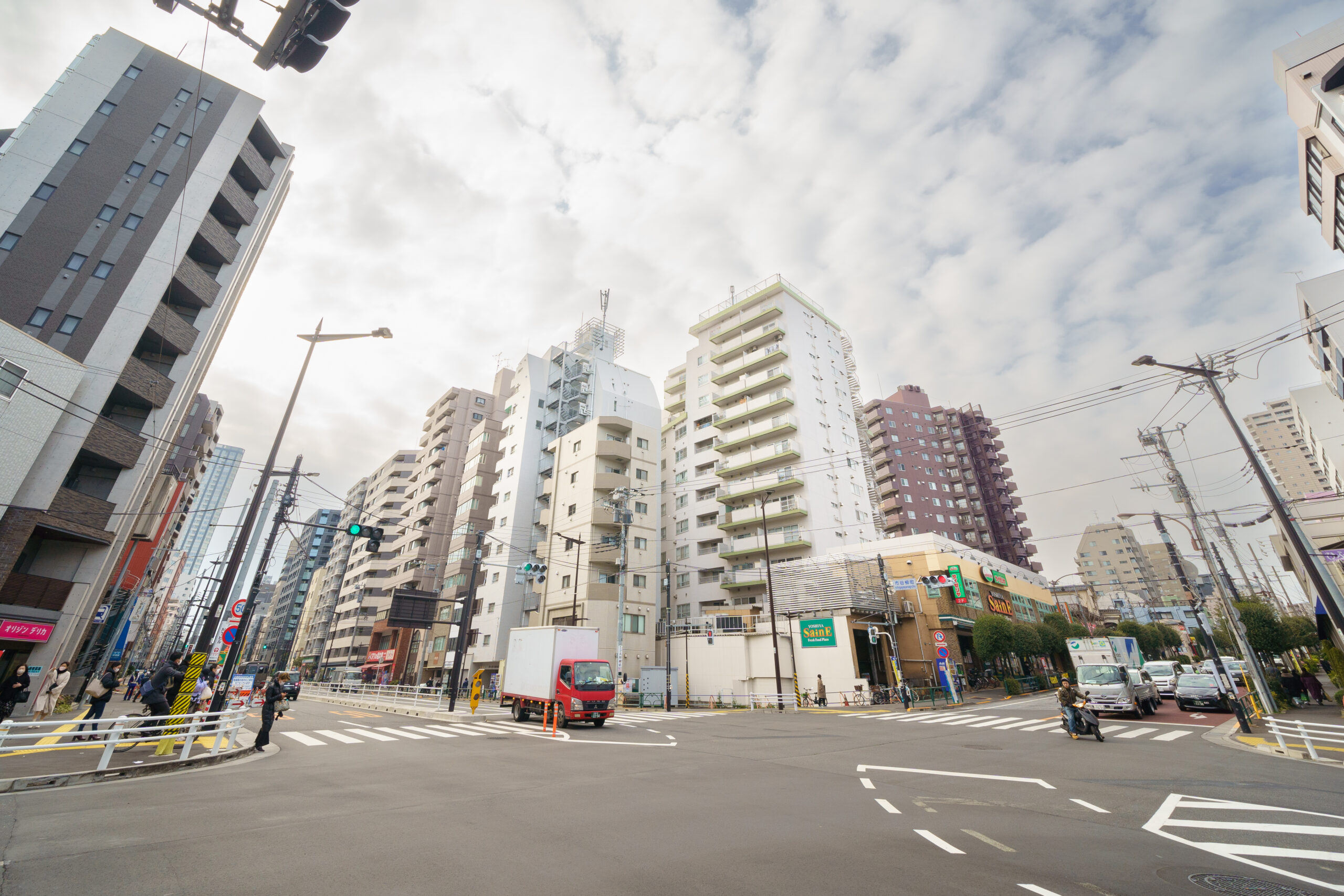
旅のスタートはモダンな洋館が目をひくレストラン『小笠原伯爵邸』
今回のスタート地点は、都営大江戸線若松河田駅の河田口から地上に上がった場所。古地図上には「小笠原左京大夫」とあるが、実はここ、今も「小笠原」なのだ。レストラン『小笠原伯爵邸』。ここからスタートして、牛込のエリアから、市ヶ谷・神楽坂方面に歩いていきます。
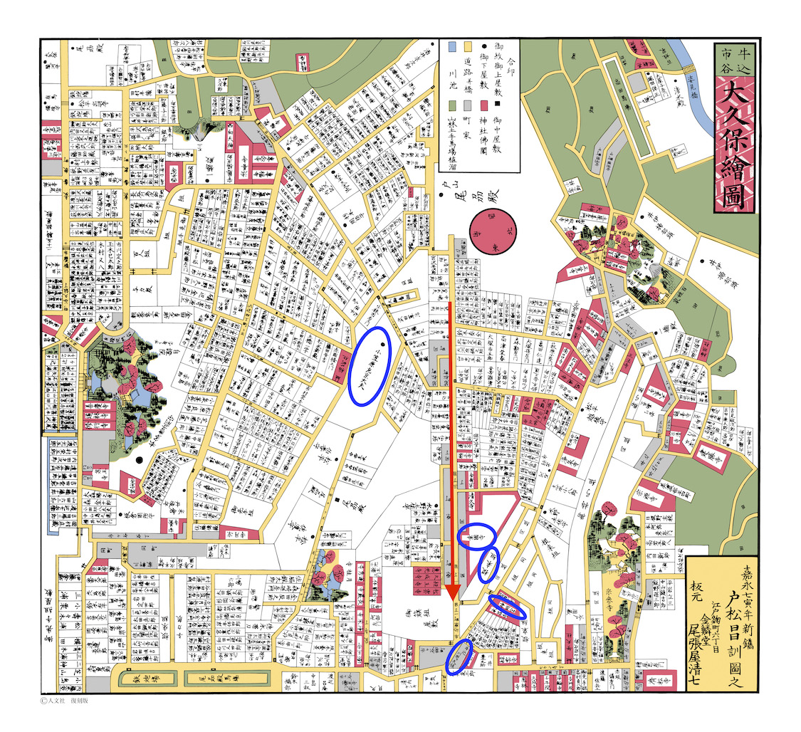
古地図で見てみるとこのようなルート。赤いラインが旅の道程、青い楕円が待ち構える歴史的スポットだ。
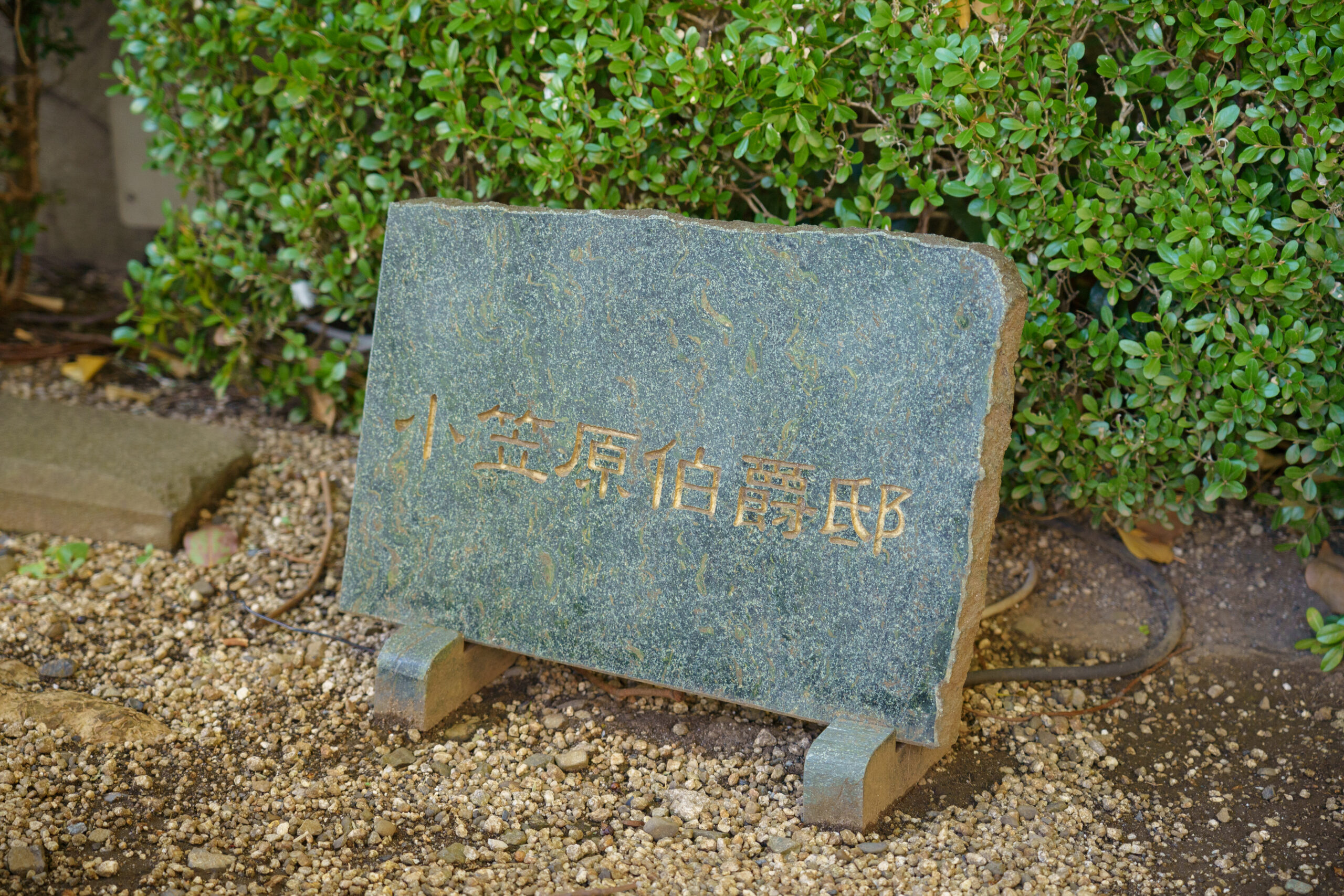
さて、スタート地点の『小笠原伯爵邸』は、モダンなスペイン料理を供するレストランだ。
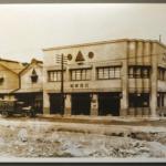
「『小笠原流』は 室町時代に起源を持つといわれる、弓術や馬術や武家社会のいろいろな儀式やマナーの流派で、徳川幕府公式の礼法です。これを司っていたのが小倉藩主の小笠原家で、その下屋敷があったのがこの場所なんです」と、星野さん。明治以降も小笠原家が所有し、今のこの建物は昭和2年に曾禰達蔵の設計で建てられたそう。
シンプルながら非常に凝った意匠のファサードに、ガラスと鉄のフラットなひさし。星野さんによると、ひさしは葡萄棚を模してあるとか。葉っぱや蔓の生命感あふれるデザインが控えめに施されていた。ドラマや雑誌などのロケ地としても有名なのだ。
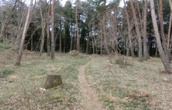
デコボコの路地を抜け、牛込台地の高低差を感じながら歩く
通りをわたってカギ型に入り組んだ狭い道に入っていく。このあたりは「大番組組屋敷(おおばんぐみ くみやしき)」があったという。大番組とは江戸城と江戸市中の警備を担当する役職。大阪城と京都の二条城の警備も交代制で行っていた。
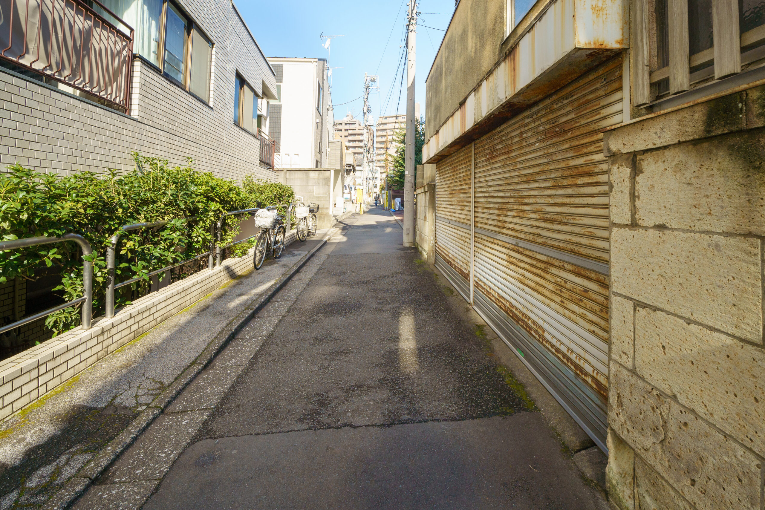
だが、現在はご覧のとおり。組屋敷の痕跡はまったくない。ここで古地図的に注目されたいのは「道幅」なのだという。この道を進んでいくと、道路はこんなふうになる。
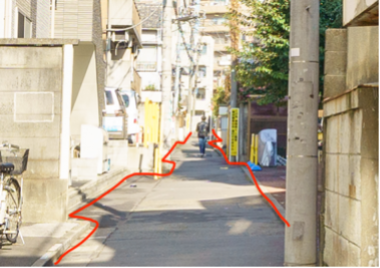
「江戸期の道幅は、おそらく1.5mぐらいだったようです。昭和25年に建築基準法が施行され、それ以降の“道路”は少なくとも4mの道幅が必須になったんです。その前からあった建物は、道幅が狭いままでも許されているんですが、その後、建物を取り壊して建て直す場合、4mの道幅を担保しないといけなくなったんですね。そのため、このように道幅がデコボコしているんです」(星野さん、以下同)
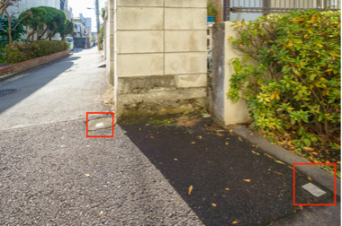
ちなみに、道路と建物の「境界」を示すのが赤線で囲った印。新しくできた建物ほど、土地がえぐられている。こぢんまりとした民家が建ち並ぶエリアでは、そりゃまあ道はガタガタになるよね。ご存知の方は当然ご存知かもしれないが、「境界」見つつ歩くのは結構楽しいことを教わった路地。
そして、今回のコースのメインストリートに出る。中野から飯田橋へと東西に走る大久保通りに出て飯田橋方面に向かう。
「このあたりは牛込台地と呼ばれる高台で、その尾根にあたるのが大久保通りです」。
意識しないと土地の高低差というものはわかりにくい。地下鉄からのスタートならなおさらだ。あまり登ってきた感覚はないのに、大久保通りより北側の土地が低くなっているのはよく分かる。そこで出くわしたのが「下戸塚坂」。
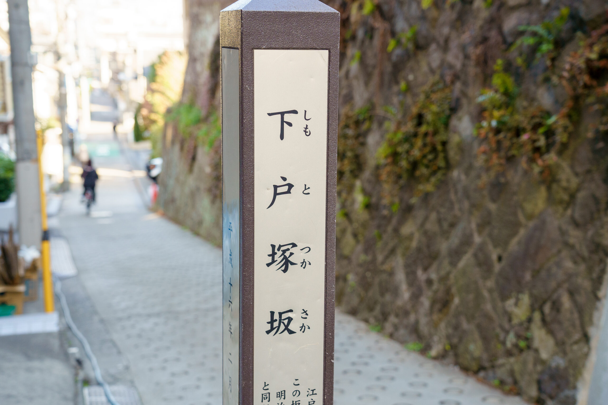
江戸時代の古地図にもこの坂はあるのだが、名前は付いていない。
「このあたりは武家屋敷の町だったので、江戸時代に町名はありませんでした。武家屋敷自体がランドマークの役割を果たしていたので、住所としての町名を設けなくても大丈夫だったんです」。
この案内板によると、下戸塚坂という名は明治5年に下戸塚町という町名ができて以降、つけられた名前だという。ちなみに大久保通りと早稲田を結ぶ「夏目坂」も、この先に出現するけれど、それも明治期のネーミング。地元の名主・夏目直克が自宅前の坂を名づけたと星野さん。ここんちの五男が、後に漱石として名をなすことになるらしいが、それはまた別の話。
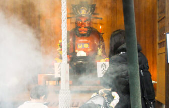
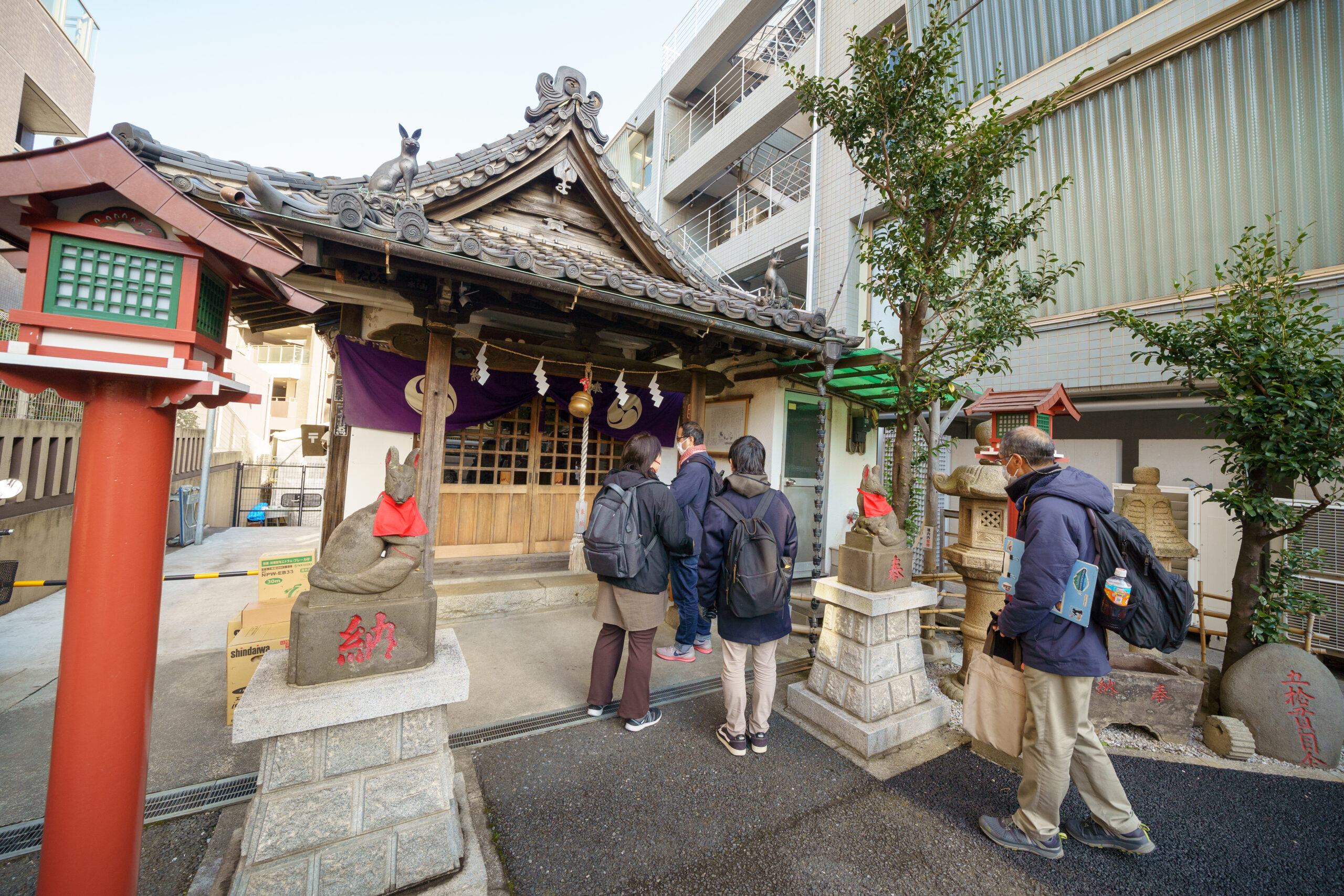
大久保通りを進むと、左手に「宝禄稲荷」という小さなお社が姿を現す。ここでお参りをしてさらに先に進む。
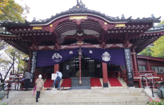
加藤清正公の下屋敷跡地にある「幸國寺」は見どころが満載
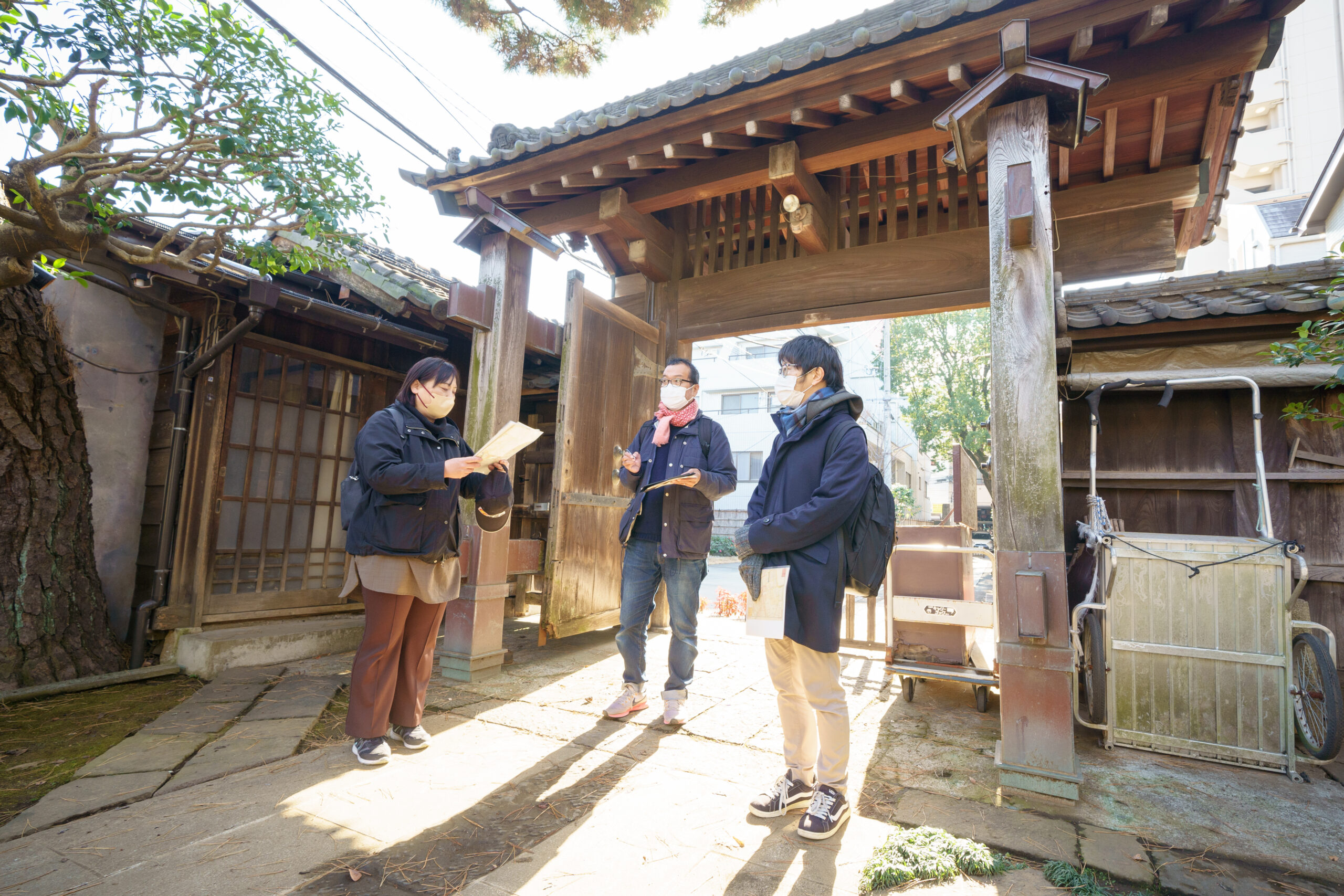
さて、われわれが歩んできた牛込台地の尾根こと大久保通りだが、途中でこんなふうに枝分かれしているのであった。今は右の通りが大久保通りの続き。
だが、江戸時代には右の道はまだなく、武家屋敷が立ち並んでいた。通りが繋がっていたのは、今、進入禁止の標識のある左の細い道。そしてその先に、加藤清正公の下屋敷の跡地に開かれた「幸國寺」がある。
具体的にお寺が建ったのは、清正公没後の1630年。子の忠広が、「除厄布引祖師」(やくよけぬのびきそし)をご本尊に祀り、江戸の町に疫病が蔓延するたびに多くの人々が頼ったという。
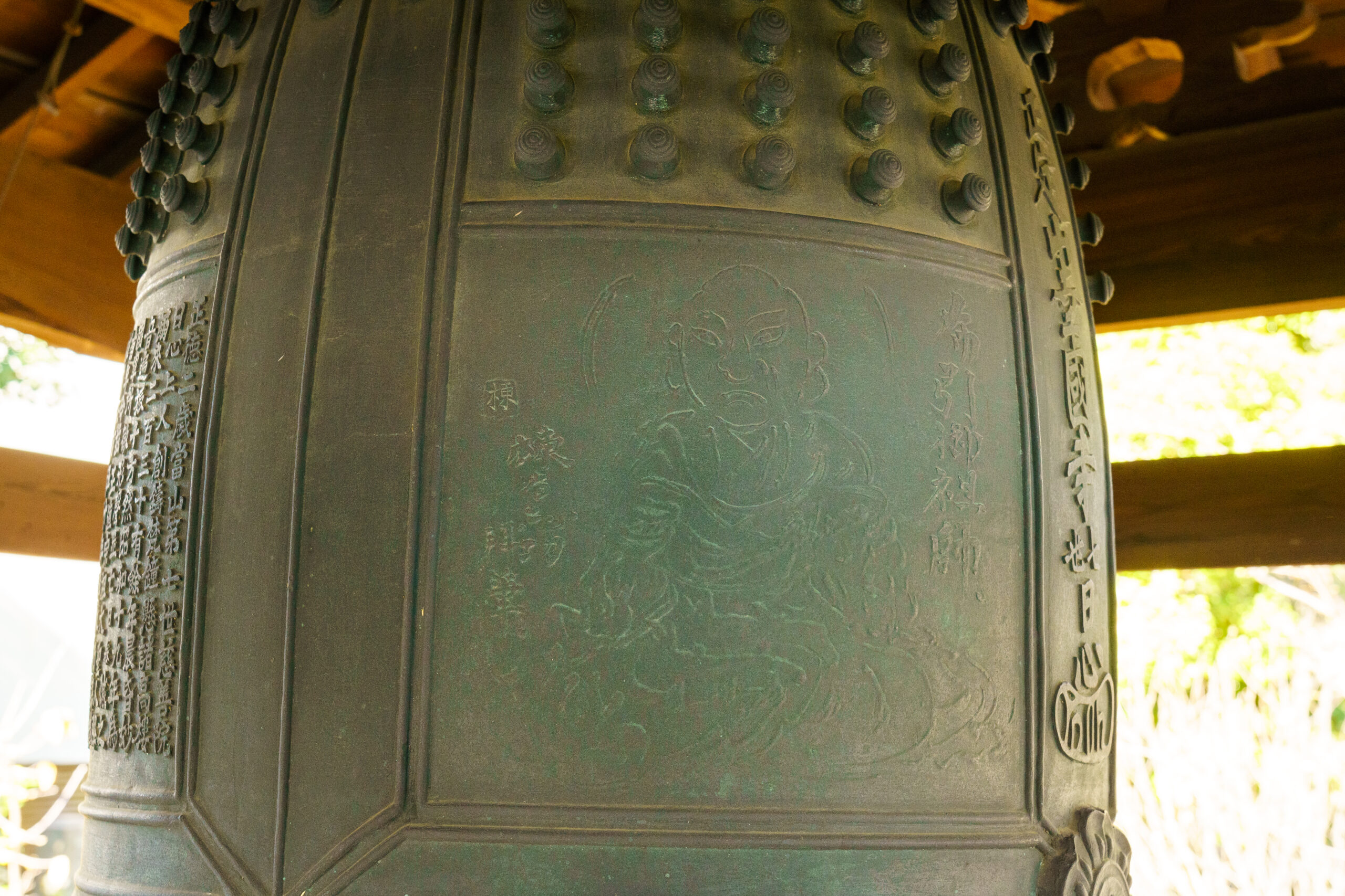
「このお寺、見どころがいっぱいなんですよ。山門は江戸後期の大名屋敷のものを、檀家の長嶋家が寄進して移築したものです。梵鐘には棟方志功によるご本尊が刻まれています。そもそも正徳2年(1712年)に納められた鐘を戦時中に供出して一度は無くなったのですが、その後、昭和46年に今の形で復元されたそうです」
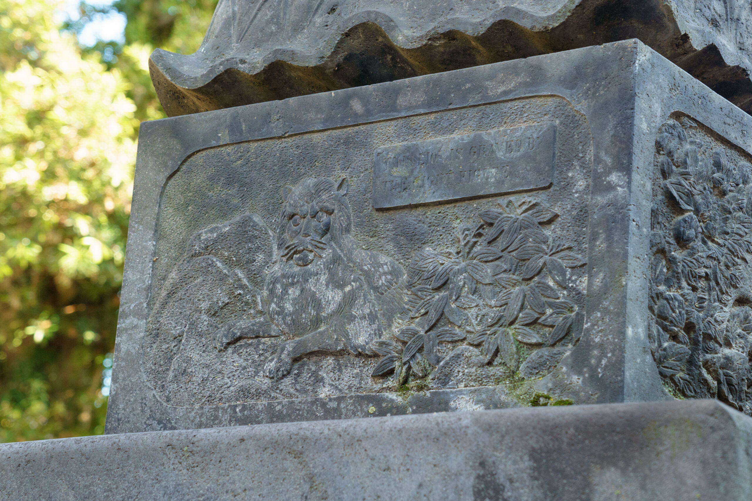
「ほかにも、150年ほど前に江戸時代の豪商・伊勢屋が建てた巨大な報恩塔。唐獅子とライオンが描かれていて、ライオンのほうは英語で銘文が刻まれてるんです。有力な商人だった伊勢屋さんが、お店の士気を高めるために建てたものだといわれています」
隅々まで手入れの行き届いたとても気持ちのいいお寺で、清正公自ら植えたという言い伝えのある推定樹齢500年の大銀杏に見守られた心落ち着く空間だ。
また、この町内には「根来組」の組屋敷があった。地図ではちょうど「幸國寺」と隣接するいくつかのブロックに「根来組」の文字が見られる。その一部は今、こんな感じ。
「根来組は、江戸幕府における『百人組』のひとつで、鉄砲を持って戦う同心100人からなる戦闘集団でした。紀伊の根来寺の僧兵だった根来衆を家康が登用したんです。古地図では、この近辺のいくつかのブロックに『根来組』『同組』と記されていますが、家の構造としては長屋がひとかたまりになって、それぞれに玄関があり、塀で囲まれていました」
と、資料の裏に組屋敷の構造をサラサラと描いてくれた。長方形がそれぞれ1軒分。なんだかワンルームっぽいけれど、「いまでいう3LDKぐらいの間取りはあったようですよ」。
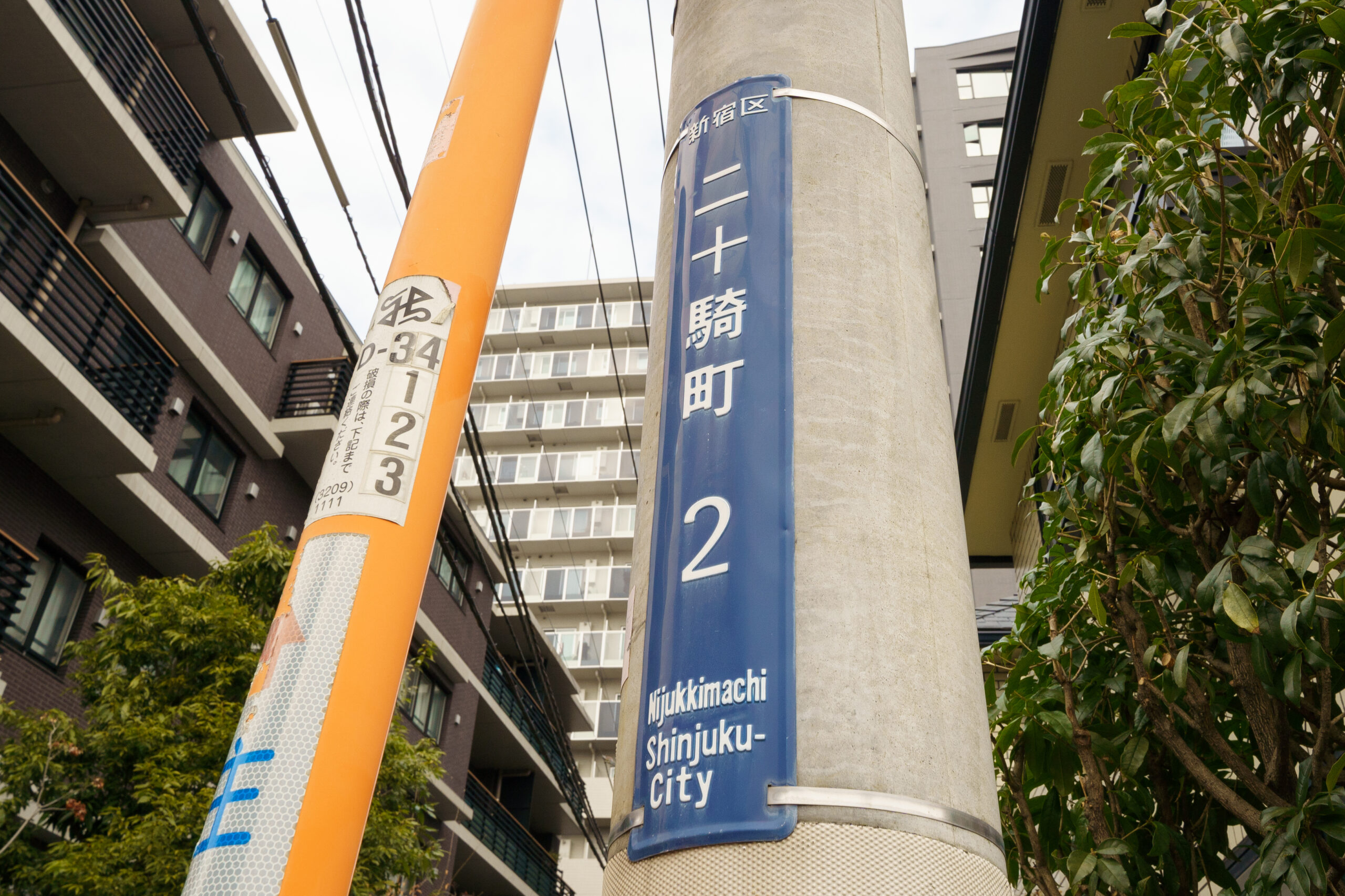
で、このあたり「牛込根来町」という俗称もあったという。なお、江戸時代の百人組は、他に「伊賀組」「甲賀組」「二十五騎組」があった。
根来組組屋敷は跡形もないけれど、古地図に「神明宮」の名で記されている「天祖神社」は、今もある。
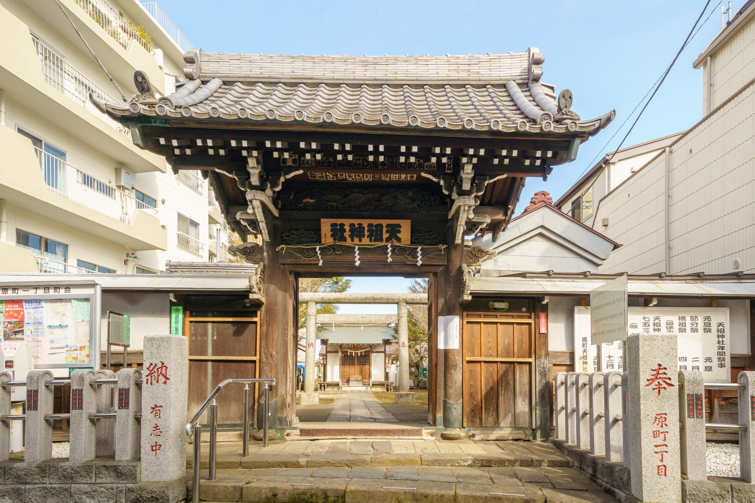
「祀られているのは天照大神(あまてらすおおみかみ)。ご存知の通り、伊勢神宮の御祭神です。武士が自らの土地を伊勢神宮に寄進して天照大神をお祀りすれば、税がかからないという鎌倉時代以来の慣例があって、神明宮というのはそうしたいわば節税対策のひとつといわれています」
境内の案内板によると、この神社が建てられたのは、江戸初期の慶長年間。諸国で神踊りが流行したが、この牛込の里でも盛んで、とくに長兵衛という村人が、神様が「ここに住んでみんなの苦しみを救うよ!」と告げる夢を五夜連続で見たことで熱心にお祈りし、その様子を見た長者の大橋龍慶が、天照皇大神宮を勧請して祠を建てたのがはじまりだとか。
神門は弘化2年(1845年)に再建され、水屋や本殿、鳥居などは大正12年のものだけれど、江戸の佇まいを感じさせてくれる素敵なお社なのである。
牛込台地を下りると甲良屋敷に由来する町名に出合う
そしてわれわれは大久保通りに戻り、今回参考にした古地図の最下部、方角でいうともっとも東にあたる地点にたどり着いた。今でいう市谷柳町交差点だ。
古地図には「牛込川田久保」と記されている。“久保”とは窪地、すなわち窪んだ土地のことなんですよ、と星野さんが説明してくれる。
なるほど、われわれがたどってきた牛込台地の“尾根”は、少しずつその標高を下げてきていたのだ。振り向けばちょっと上り坂になっている。で、交差点を通り過ぎ、そのまま星野さんの案内で裏道に入っていく。実はこの場所、もはや古地図からはみ出しているのであった。
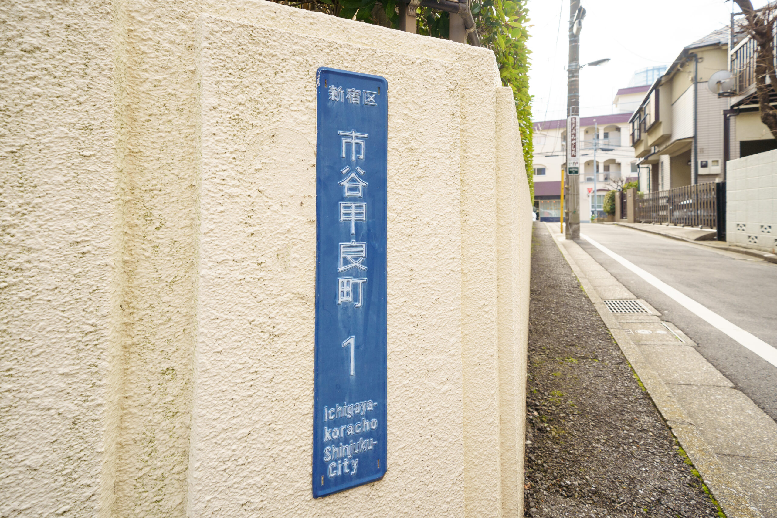
別の古地図には「河田ヶ窪」と記されている「川田久保」を通り、裏道に入っていくとそこは現在の住所で市谷甲良町。江戸の地名に由来する。
「近江出身の甲良(こうら)家がこの場所に土地を拝領したんです。鎌倉八幡宮や芝増上寺台徳院霊屋、日光東照宮の改築など、幕府の重要な建築を取り仕切った『幕府作事方大棟梁』を代々務めた大工の家系です」
屋敷を建てただけでなく、土地を町民に貸し与え、このあたりは市街地としてずいぶん賑わったと、星野さん。「それで、甲良屋敷内にあったのが……」
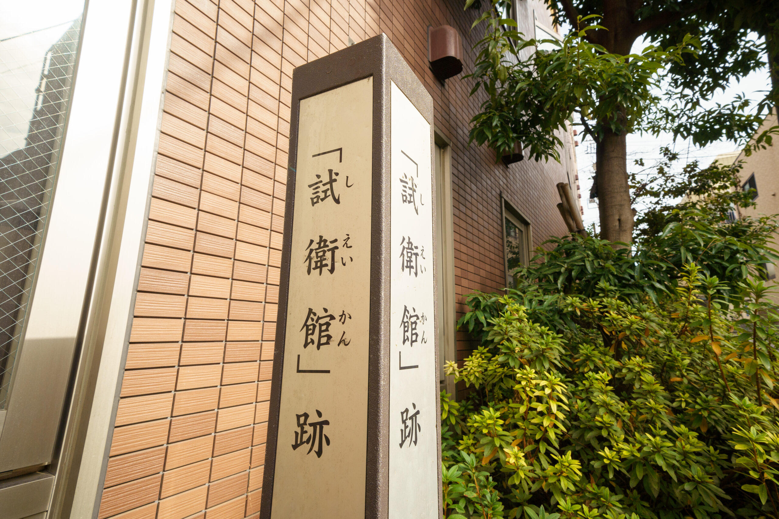
「新選組局長・近藤勇の道場『試衛館』です。土方歳三や沖田総司など、有名な隊士たちが若かりし日から腕を磨いたのがここなんですね」
今は瀟洒な介護施設の脇に標識が立つだけだけれど、甲良屋敷だったことがそのまま住所として残っているのだ。そしてこのエリア、江戸に由来する地名が多いのである。
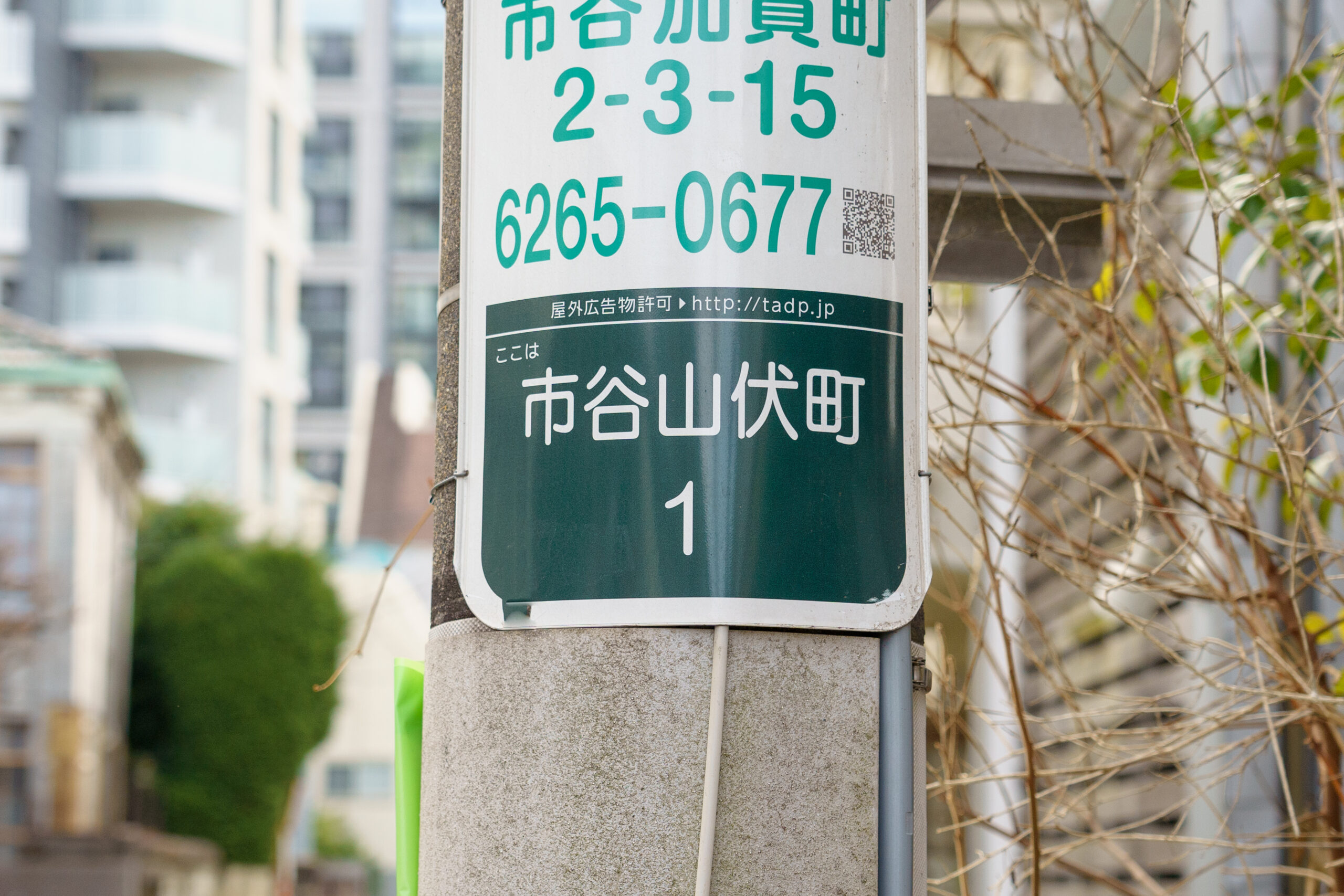
「市谷山伏町」「納戸町」「二十騎町」……町名に残る江戸の名残
次に訪れたのは、甲良町から少し坂を登った場所。そして見下ろすのは市谷柳町交差点……江戸時代の「川田久保」。
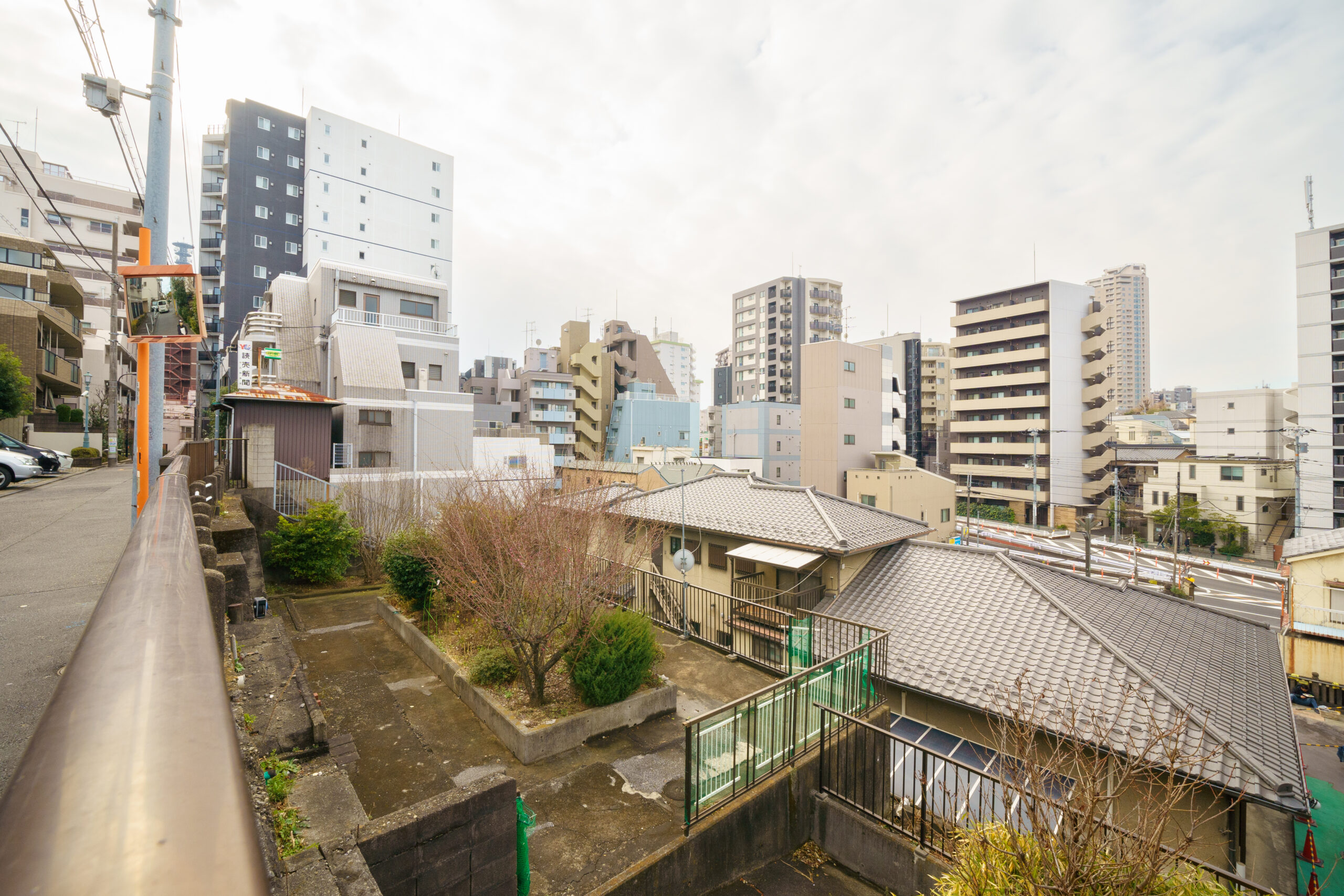
「ここからだと一層高低差があるので、窪地がよく分かると思います」
写真中央あたりが市谷柳町交差点。ここから見下ろすと「川田久保」はまさに窪んでいることがはっきりわかる。
また、写真から見下ろすエリアには江戸初期に山伏や修験者がたくさん住んでいたことから「市谷山伏町」という町名が残っている。でも実は、享保八年(1723年)の大火で下谷に転居したということなので、ずーっと“山伏町”というわけでもなかったのだ。
むしろ、その後もずっとこの町にあったのは「林氏墓地」。徳川幕府に仕えた儒学者・林羅山とその一族のお墓である。今はお墓だけだが、元々はここに屋敷もあったらしい。
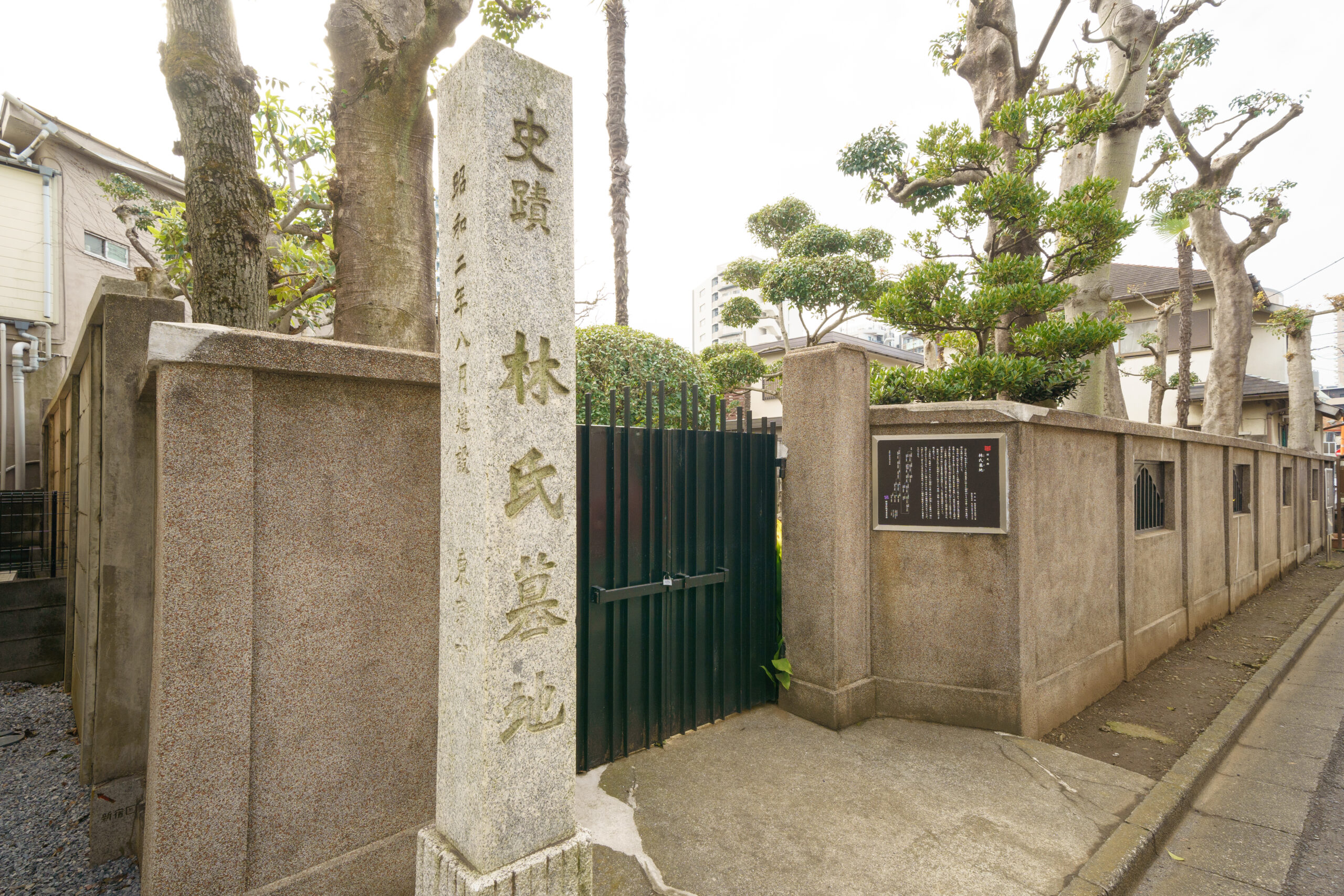
「そもそも林羅山は上野に別邸があって、墓所が敷地内にあったので羅山と一族はそちらに埋葬されていたんですが、元禄11年(1698年)にこの土地に屋敷を拝領したタイミングで、墓地も牛込の屋敷内に移されたんです」
屋敷はもっと広大だったらしいのだが、明治維新の後に縮小されて今はお墓のみが残る。今回は道すがら、敷地の外から覗いてお参りした。
「現在は81基の墓石が立っていますが、儒教の様式として残るのは、八代林述斎から十一代復斎までの4基だそうです」。星野さん曰く、現存する儒葬墓はとても貴重なのだそう。石で囲われた長方形の墓所にそれぞれ木が植えられていて、見たことのないお墓の風景が広がっていた。
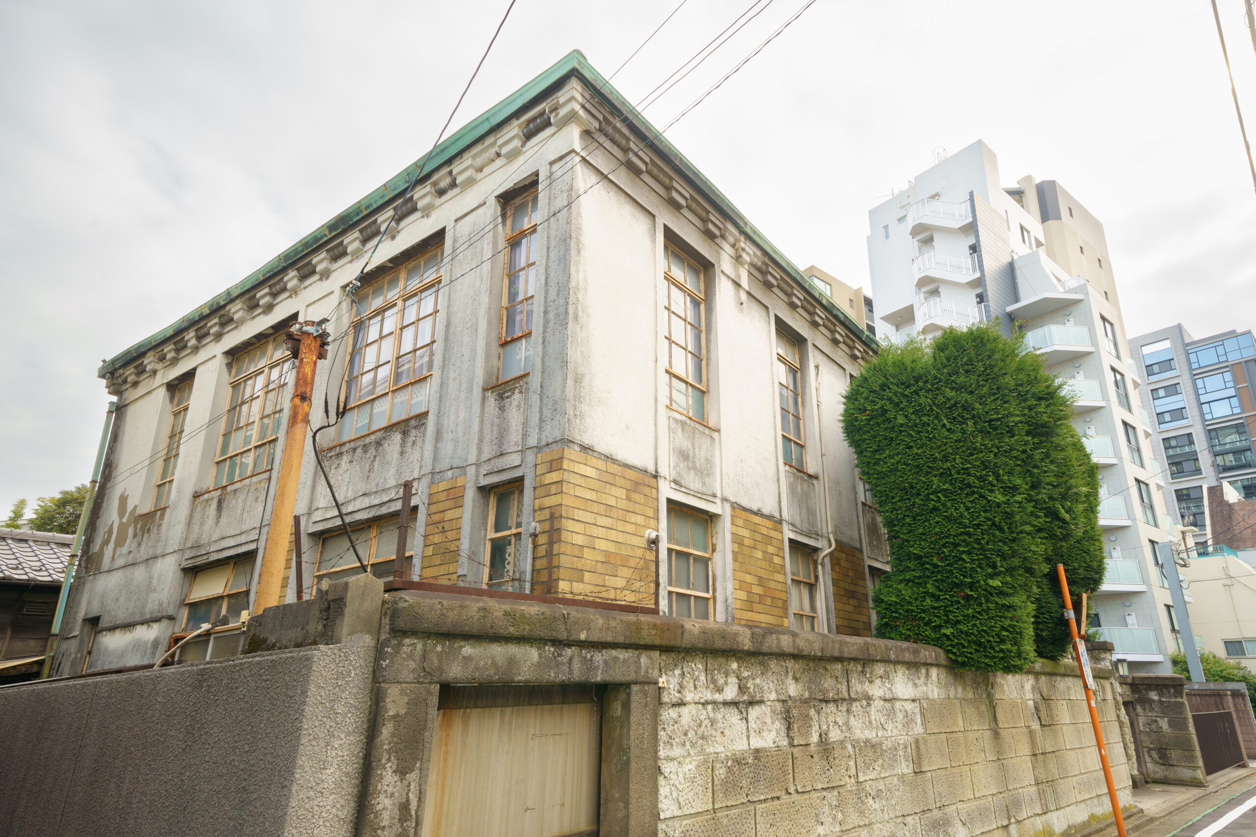
時代はまったく異なるのだが、林家墓地のすぐ近くには登録有形文化財の「新井家住宅主屋」が見られて、これもまた町の風景にすんなり溶け込んでいる。
住宅街にそこそこ広いプライベートな墓地(調べたら約360㎡らしい)があり、昭和はじめのカッコいい洋館がしっかりと残されていることに、なんだか “町の余裕”みたいなものを感じるのであった。
そしてわれわれは、都心なのにすごく静かで住み心地良さそうな住宅街を、リュックをしょって地図を片手にさらに歩く。お店も劇場もスーパー銭湯もなく、住民かその友だちか配達の人ぐらいしか訪れなさそうな街である。そんな“知らない街”を地図片手に歩き、住所表示を撮影する異質さと面白さを改めて認識する。
なぜ撮影しているかというと、やはり地名が江戸に由来するから。
「ここに先手与力の屋敷があったんです。先手与力というのは、江戸城の門の警備や将軍が外出する際の護衛、江戸市中の巡視などを担当した役職で、この通りの両側に1組10人の先手与力が、2組暮らしていたことが地名の由来です」
そしてまた、こんな電柱も普通なら撮影しない。でも堂々たる被写体と化しているのは、この納戸町(なんどまち)という町名も江戸時代の役職が元になっているから。
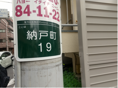
納戸というと、今でも物置的な場所を意味するが、そもそも幕府には「納戸役」という役人がいたらしい。
「将軍家の金銀や衣服、調度、献上品を管理する役人です。彼らの屋敷があった場所だから、納戸町。古地図にも『納戸町』として記述されていますよね」と星野さん。
納戸町を通り過ぎると新宿区「中町」という住所に入っていく。今の地図を見ると、上から「北町」「中町」「南町」という区分になっている。実はこれも、江戸の地名の由来なのである。もとは「御徒組(おかちぐみ)」という、文字どおり馬には乗らず徒歩でお役目を果たす下級武士の組屋敷があった地域だとかで。
「御徒組南町」「御徒組中町」「御徒組北町」と俗に呼ばれていたそう。それが今も残っているとのこと。組屋敷は、先に紹介した根来組同様にブロックごとに塀で囲われた長屋だったので、今もこの3つの町には行き来できる路地はない。
旅の終わりは、誰もが知るあの曲を作曲したことで知られる「宮城道雄記念館」
一見プレーンな町名に見えるが、江戸の色合いが意外に色濃く残っている。そんな旧「御徒組中町」には、古地図散歩という文脈とはまったく関係なく「宮城道雄記念館」が待ち受けていた。
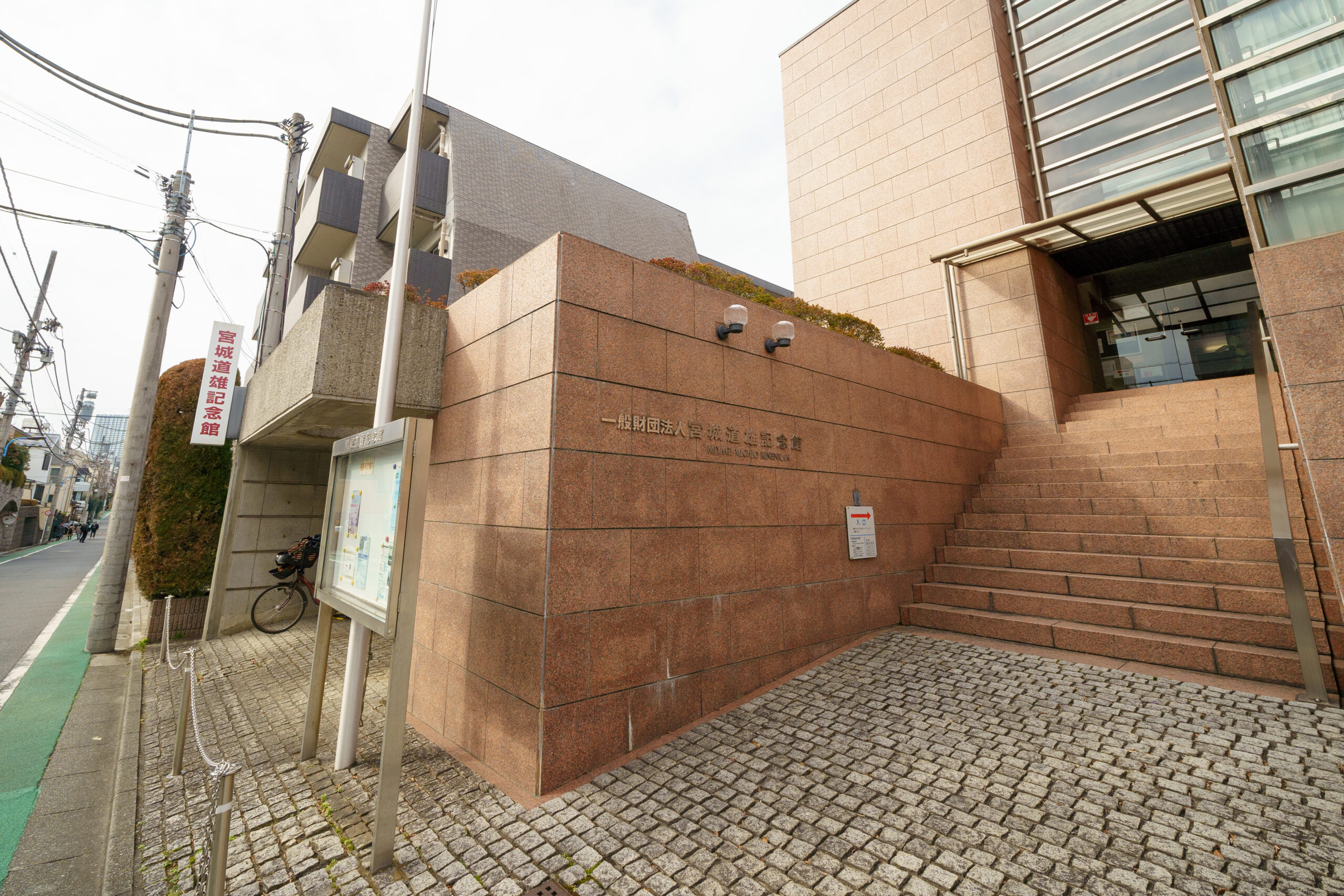
正直、瞬時にその名にピンとこないのが恥ずかしいかぎりなのだが、軒先の説明板で強く膝を打ったのであった。
宮城道雄さんは、大正から昭和にかけて活躍した箏曲家・作曲家である。あの有名な「春の海」の作者……といっても伝わりにくいなら、お琴のこんなメロディーを脳内再生してみてほしい。
♪チャン、チャリラリラリラン〜 チャン、 チャリラリラララ〜ン♪
そこに尺八が加わる。
♪パフォ〜〜パ〜パラララ〜ララ〜♪
たぶんわかるでしょ? お正月になると、どこかしらで必ず聴くことができるアレです。
アノ曲をはじめ、400曲あまりの箏曲をつくり、宮城流を打ち立てた宗家の終の棲家にして記念館。江戸の古地図を片手に新宿区を歩いていたら、偶然にもたどり着いてしまった。テーマは「江戸から残る地名」だったはずなのに、全然関係ない、でも日本文化に深く関わる音楽に遭遇。古地図を元に町を歩けば、古地図の時代を思い返せるのはもちろん、思いもよらぬカルチャーに出合うことができる。
やっぱりホントに歩いてこそだよなあ、と強く実感する旅なのであった。
取材・文/武田篤典(スチーム)
写真/大久保 聡
取材協力/歩き旅応援舎