東京は歴史ある“都市”だ。太田道灌が15世紀半ばに江戸城を建てたときは、入り江に面した湿地帯の漁村だったが、16世紀末以降に徳川家康がやってきて都市としての開発が始まった。目前の入江を埋め立てて街区を整備し、城の周囲に長大な堀を巡らせ、玉川上水をつくって生活用水を確保し、町中に水路をつくって物流網を築いた。そして18世紀には100万都市に。
ササッと検索するだけでこのぐらいのことはわかって、江戸ってすごいなあってぼんやりと思うこともできるが、実際に歩いて見てみればもっと面白い。東京には江戸時代以降の古地図がたくさん残されていて、同じ区画や通りや建物があって静かに感動できたりたりするし、「あの通りなかったの⁉」とか「昔の屋敷、デカッ!」的な驚きも得られる。
そんなふうに古地図とともに江戸〜東京の街の様子を歩いて見てみるのがこのページの趣向。東京を古地図とともに歩くツアーの先駆者である「歩き旅応援舎」のガイドさんに案内してもらい、東京各地を歩き回ります。
城のお堀の内側に住む“城塞都市”・江戸
第1回は、まさに江戸発祥の地・江戸城の間近も間近、丸の内。今回案内してくれたのはガイドの星野多慧さん。バスガイドを経て歩き旅応援舎でのガイド歴は約3年だそう。
今回歩いた丸の内エリアの江戸時代後期の古地図がこちら。「御城」とは江戸城、今の皇居。「御城」の右手のお堀は今も残っているが、地図右端の南北を貫くお堀は今は埋め立てられ、これに沿った東京駅八重洲口側の大通りは「外堀通り」と名付けられている。そう、このお堀は「外堀」。

「丸の内は、お堀の内側という意味です。お堀というと、城内と町を隔てるために掘ったイメージがあるかもしれませんが、江戸城の外堀は市中に全長15kmにわたって掘られていて、その内側にも武士や商人が暮らしていました。ヨーロッパの古い街って城壁で囲われていて、その中に町もお城もあったりしますよね? あの城壁がお堀になったのが江戸の町ですね」
いつでも出勤できる、丸の内は江戸城の職住近接
このエリアは江戸城の本丸にも近く、有力な大名の上屋敷が集中していたという。上屋敷とは大名たちのお城の“最寄り屋敷”。毎日お城に出勤する現役世代が暮らしていたらしい。有力な大名はほかにも中屋敷や下屋敷を構えており、隠居した先代が住んでいたり、家来たちが住んでいたりと、お城から離れるにしたがってオフィシャル度は弱まり、その分、建築やお庭に凝ったりと趣味性が強くなった、と星野さんは説明してくれた。

まず訪れたのは「道三堀」。東京駅丸の内北口から丸の内オアゾを貫通、古地図でいうと松平伯耆守の屋敷の一角から細川越中守の敷地を通り抜けたことになる。ビルから出るとそこは永代通り。ここにかつてあり、和田倉門のあたりにつながっていたのが「道三堀」だ。
「家康が江戸城に入ったときに最初につくった水路です。江戸城の工事のための資材を運ぶ水路としてつくられたんです。地図に『道三川岸』とありますが、川岸とは荷物の上げ下ろしをする場所のことです」
現在お堀はなく、永代通りはまっすぐ皇居の大手門(地図①)へと通じている。

いわば江戸城の正門で、城と城下町をつなぐ正式な出入り口。今は皇居東御苑の入口となっている。
和田倉噴水公園はWi-Fiも飛ぶ都会のオアシス
永代通りを皇居に向かって進んでいき、日比谷通りを南下する。擬似的に船で道三堀からお城に向かったような気分。たどり着いたのは江戸城和田倉門に通じる「和田倉橋」(地図②)だ。
「海を古語で “わた”というんですが、江戸時代は日比谷の入り江がこのあたりまで来ていて、それにちなんで“わたくら”と名付けられたそうです。この和田倉橋は、江戸城のころの木の橋を再現したもので、いまこうした木橋は皇居東御苑の入口になっている平川橋とこの橋のふたつだけなんです」

和田倉門は「枡形門」といわれ、上から見ると周囲を「枡」で囲い、実際に出入口が2箇所ある構造。外敵は一気に通過できないので、ここで留められ、門の内側から矢で狙われたという。ちょうど古地図も「枡形」がわかりやすい表現になっている。
この門をくぐって「城内」に入ると、そこは「和田倉噴水公園」になっていた。優美な噴水があり、スタバが営業中でWi-Fiも飛んでいる。非常に仕事がはかどりそうな都会のオアシスだった。
荒れ野原だった明治維新後の丸の内
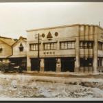
さて、和田倉噴水公園から再び和田倉橋を渡ってくると、目の前は高層ビルが建ち並ぶ現代の丸の内……のように見えつつ、ここにも歴史の過去の痕跡があるのだった。写真のピカピカしたビルは「みずほ丸の内タワー・銀行会館・丸の内テラス」(地図③)。


前身は大正5年(1916年)に竣工した「東京銀行集会所」。塔屋を擁したレンガ造りの2階建てで、1993年に建物2面の外壁を残して高層ビルに建て替えられた。それがさらに2016年に建て替えられ、「みずほ丸の内タワー・銀行会館・丸の内テラス」となっている(2018年1月新築着工開始、2020年9月末竣工)。かつての外御壁も解体され、今はビルの足下で昔の建物のレンガの外壁の模型と、建物の解説を見ることができる。
江戸城界隈が江戸の都市開発の先駆けならば、丸の内は東京の都市開発の先駆けだ。
明治維新を機に、このエリアは新政府に接収され軍の練兵場や宿舎などに使われた。星野さんによると、大名屋敷を取り壊して新しい施設を建てた区画もあれば、放置されたところもあり、むしろ江戸末期よりも荒れ果てたという。自然主義の文学者・田山花袋は当時の丸の内を「陰気で、さびしい、荒涼とした、むしろ衰退した気分」と描写したほど。
三菱が劇的開発により再生させた丸の内をたどる
それが明治23年(1890年)、三菱がこの一帯の払い下げを受けて開発に着手。軍の施設が次々移転し、草ボーボーの荒れ地と化して「三菱が原」と呼ばれた10万坪あまりの土地を、日本の新たなビジネスの拠点にすべく作り直した。
たとえば、さっきの「みずほ丸の内タワー・銀行会館・丸の内テラス」の脇を東に進むと、江戸時代にも、明治維新後にも存在しなかった通りを渡る。
「丸の内仲通り」だ。
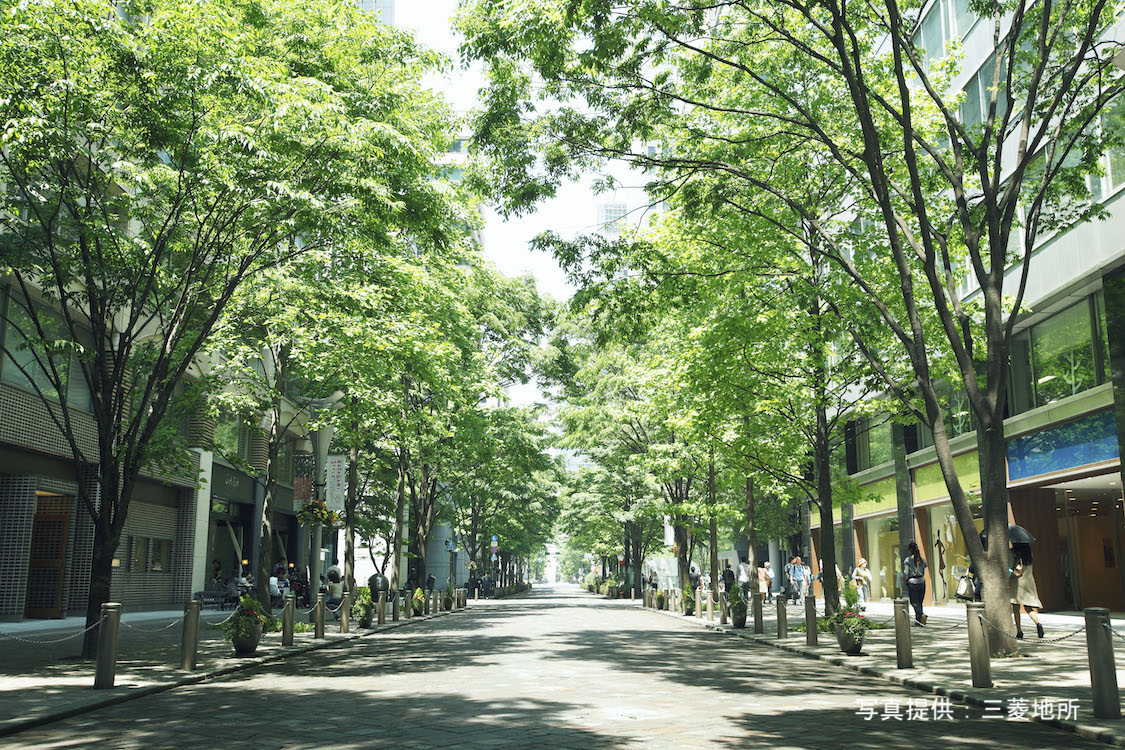
「丸の内」というと、ほとんどの人がここを思い浮かべるのではないだろうか。国内外ハイブランドのショップが軒を連ね、洒落た飲食店がオープンテラスを出し、アートが飾られ、イルミネーションがきらめく石畳のストリート。
江戸末期までは大名屋敷、明治中期までは軍用地だった区画に、開発によって新たな通りが一本通ったのだ。丸の内と言えばここというくらいよく知られた通りなので、古地図と見比べて得られる新たな驚きだ。
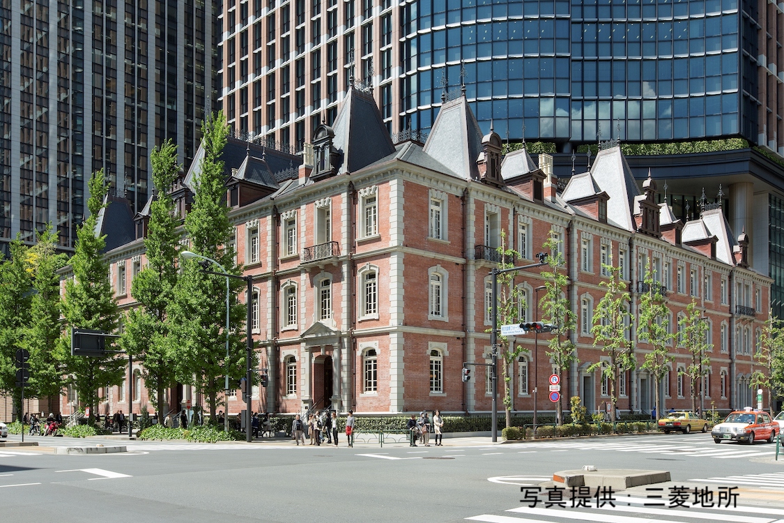
そして今や「丸の内1st」と名付けられた通りを進んでいくと、左手に「日本工業倶楽部会館」(地図④)が見えてくる。

日本の工業を発展させるために実業家たちが創立した団体の拠点。こちらは平成15年(2003年)に建て変えられたものだが、もともとは大正9年(1920年)の建築。
「建築様式のクラシックな感じもそうなのですが、正面入口の上にある像に注目してください。男性はハンマー、女性は糸巻きを手にしています。当時の主要な産業であった炭鉱と紡績の現場の労働者を象徴したものです」
70年以上も旧丸ビルを支えた松の杭
そして、丸の内2st沿いに丸の内仲通りと大名小路の間に立つのが「丸ビル」(地図⑤)。食事や買い物に訪れたことがある人も多いと思うが、星野さんはわれわれを見知らぬエントランスに導いた。行幸通り沿い側のビルの脇にあるドア。
その先に人気のない吹き抜けになったホールのようなスペースがあり、「杭」が展示されているのであった。

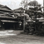
「旧『丸の内ビルヂング』(写真上)の基礎となった松杭が、建物を支えるために地盤の安定した東京れき層に達するように打ち込まれていたんです。その数5443本。“旧丸ビル”が竣工したのは大正12年(1923年)の2月で、同じ年の9月に関東大震災が発生したんですが、丸ビルはびくともしなかったそうです」
丸ビルには何度も来たことがあるけれど、こんな場所全然知らなかった。そしてもうひとつ、こちらも知らなかった。ビルの南側にひっそりと設置されている船の銅像(?)

オランダの航海士、ヤン・ヨーステンが日本に乗ってきた帆船・リーフデ号。といっても船は座礁し、彼はウイリアム・アダムス(三浦按針)とともに漂着するのだが。
ヤン・ヨーステンは徳川家康の信頼を得て、城内に住まい、東南アジア方面との御朱印船貿易をおこなった。
「日本名を耶揚子(や・ようす)といい、彼にちなんで江戸末期には今の日比谷通りあたりを八代川岸(やよすがし)と呼んでいたんですが、これが八重洲の語源といわれています」
今の地名でいうと八重洲は、東京駅を挟んで丸の内とは反対側になるのだが、そもそも八重洲も丸の内の側にあったのだ。
本気の復元・三菱一号館と一丁倫敦
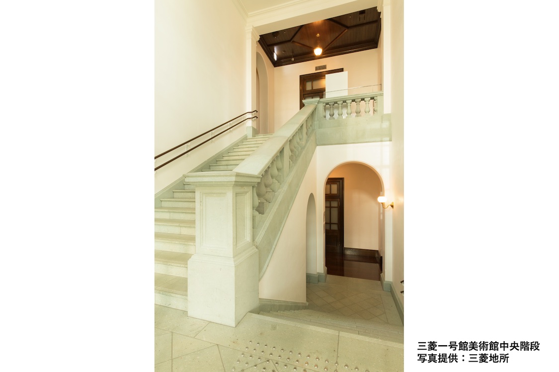
三菱は丸の内を買い上げて以降、そっくり街を作り上げてさまざまなビルを建ててきたが、その最初が「第1号館(三菱一号館)」(地図⑥)。日本政府が英国から招聘したジョサイア・コンドルの設計で明治27年(1894年)に竣工した。
「日本のオフィスビルの先駆けとなりました。今のオフィスビルのように館内に入ってロビーから各オフィスに行くのではなく、それぞれのオフィスの入口が外側にあって、各オフィスが独立した形になっています。通りから直接短い階段を上って各オフィスに入るんです」
元の建物は昭和43年(1968年)に取り壊されましたが、時を経て平成212年(200910年)に復元竣工。平成22年(2010年)には、いまの「三菱一号館美術館」として開館しました。
「まさに“復元”という言い方は正しくて、明治時代の実際の設計図やさまざまな文献を元に、解体時に保存していたパーツを再利用したり、昔と同じ製造方法でつくった部材を使用したり、元の建物に可能な限り忠実につくられているので、ビルの中も見どころいっぱいなんですよ」

「第1号館(三菱一号館)」が建てられたのは、皇居外苑馬場先門に通じる馬場先通り。同じ通り沿いに「第2号館(三菱二号館)」「第3号館(三菱三号館)」、そして渋沢栄一が設立した「東京商法会議所」が10年うちに建てられ、広々した通りに高さをそろえた西洋建築が立ち並ぶ様子から、この界隈は「一丁倫敦(ロンドン)」とよばれるようになったらしい。

当時の建物はもう残っていないけれど、かつて「第2号館(三菱二号館)」のあった場所にはいま、「明治生命館」(地図⑦)が建っている。


“跡地”とはいえ、昭和9年(1934年)竣工という歴史ある建物で、昭和20年9月から11年間にわたってアメリカに接収され、極東空軍司令部として使われていた。
「昭和の建物として初めて重要文化財指定されています。正面の円柱も見事ですが、ディテールも楽しいですよ。窓の金属製のグリルをはじめ、ロゼットと呼ばれるお花や、イルカの意匠があって見どころたっぷりの建物だと思います」
かつて都庁があった場所。東京国際フォーラムの太田道灌
皇居外苑の馬場先門から始まる馬場先通りの反対側の端っこには、いま「東京国際フォーラム」(地図⑧)が佇んでいる。これはかつての東京都庁。元を正せば「東京府庁舎」があった場所。

赤レンガ2階建ての東京府庁舎の完成は明治27年(1894年)。戦災で焼失し、その後、丹下健三の設計で第一庁舎が竣工。平成3年(1991年)に東京都庁は、いまの西新宿に移転した。
ライブやイベント、地下にある「相田みつを美術館」には足を運んだことがあるし、ここが都庁跡だということも知ってはいたが、この碑の存在は知らなかった。
そして、たぶん何度も通っているはずだし、令和3年(2021年)の大晦日にはアイドルグループが歌う映像も見たのに、「そこ」に「そんなもの(人?)」がある(いる?)のも全然知らなかった。4つホールと向き合って建つ「ガラス棟」の「太田道灌像」。江戸城築城500年を記念して旧都庁につくられたものだそうで。


徳川家光の時代の江戸城天守閣の模型や、各地の道灌像の紹介などがなされる道灌コーナーが設けられているのであった。
「旧都庁のときは屋外に設置されていて、移転時に西新宿に連れて行かれるのかなと思っていたんですが、取り残されましたね(笑)。でも、道灌さんはご自分が建てた江戸城の近くにいるほうがいいのかもしれません」
というわけで、東京駅丸の内北口から丸の内界隈を経由して東京国際フォーラムまで。たぶん普通に歩けば20分程度の道程をゆったり3時間ほどかけて散策。実はまだ紹介し切れていないところもあるのだが、そこはそれ、みなさんご自身でぜひとも歩いて見てみてください。
取材・文/武田篤典(スチーム)
写真/大久保 聡
取材協力/歩き旅応援舎
今回のまちめぐりOutline